


Glenha Bikerafting Loop
Distance
115 Mi.
(185 KM)Days
4
% Unpaved
52%
% Singletrack
13%
% Rideable (time)
85%
Total Ascent
7,838'
(2,389 M)High Point
1,460'
(445 M)Difficulty (1-10)
8?
- 4Climbing Scale Fair68 FT/MI (13 M/KM)
- 8Technical Difficulty Difficult
- 8Physical Demand Difficult
- 7Resupply & Logistics Strenuous
Contributed By
Nima Khorshidi
Guest Contributor
Nima is a bike mechanic and a cycle trainer in Glasgow. He started cycling and going on long day trips in Iran at a very young age, and it soon became his passion. In Scotland, Nima has cycled most of the established bikepacking routes and is now enjoying exploring new routes and sharing them with fellow bikepackers. Follow Nima’s rides on Instagram at @milesandwheels.
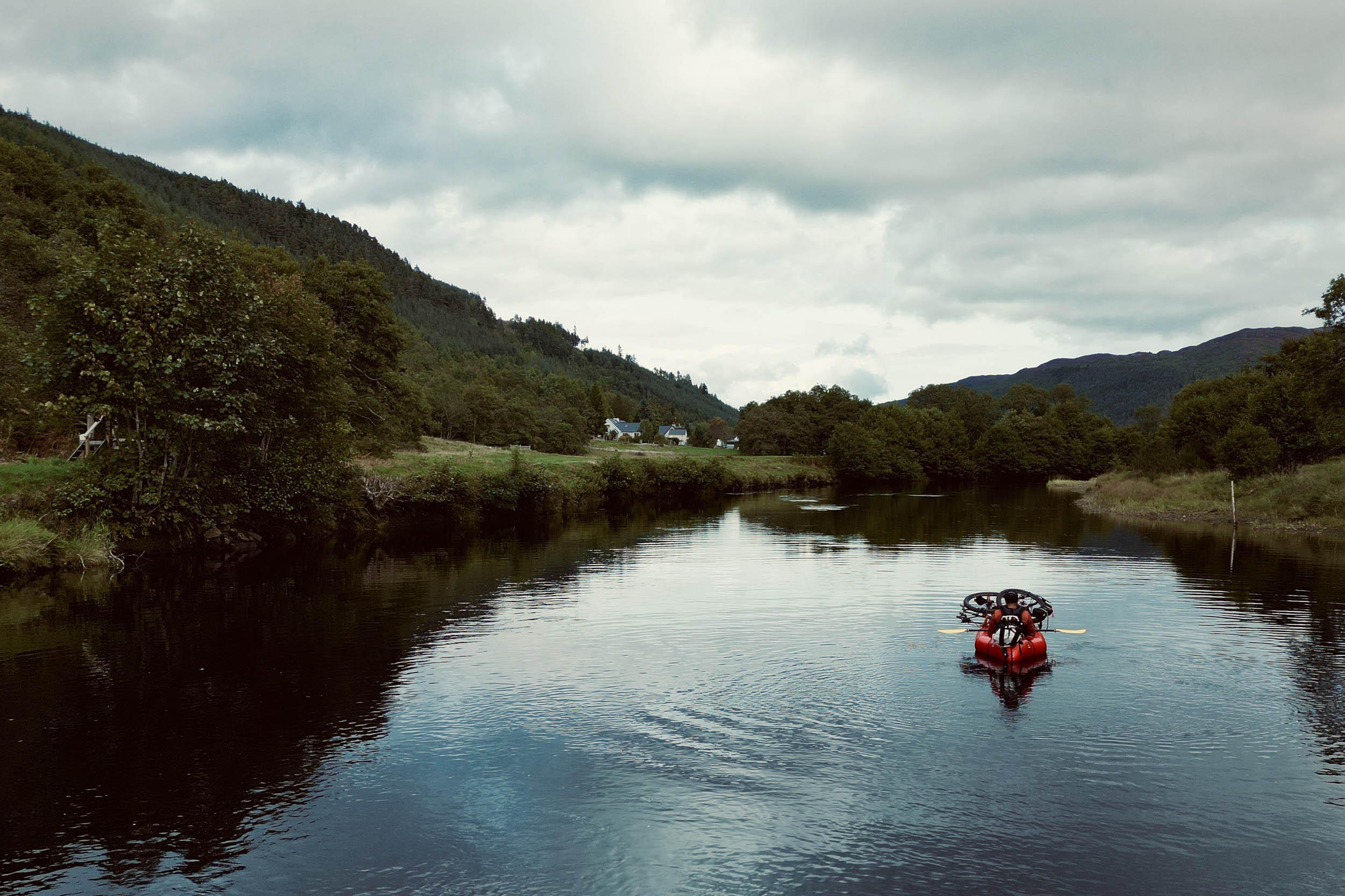
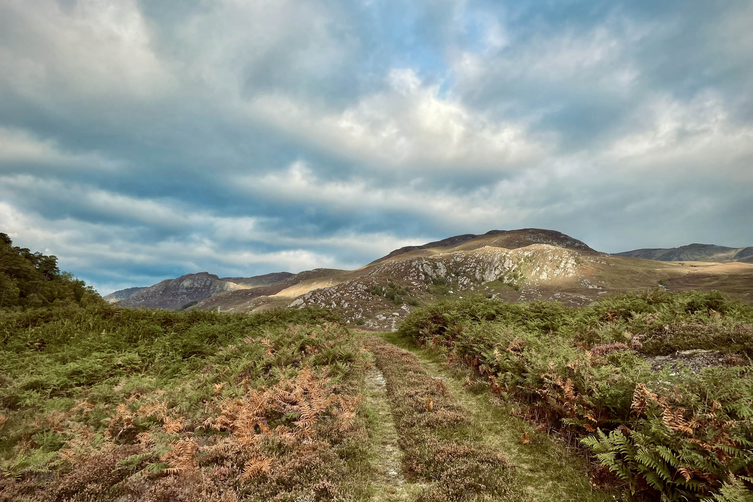
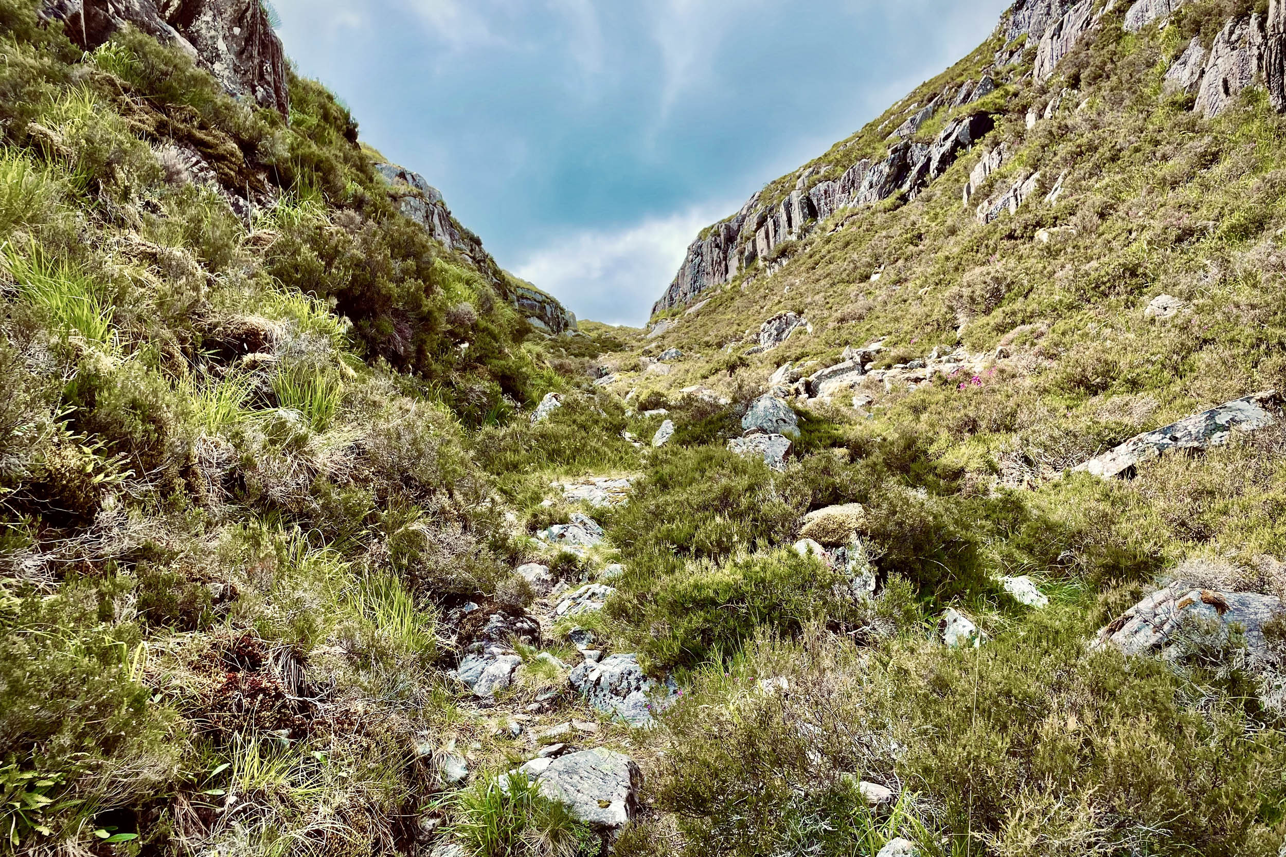
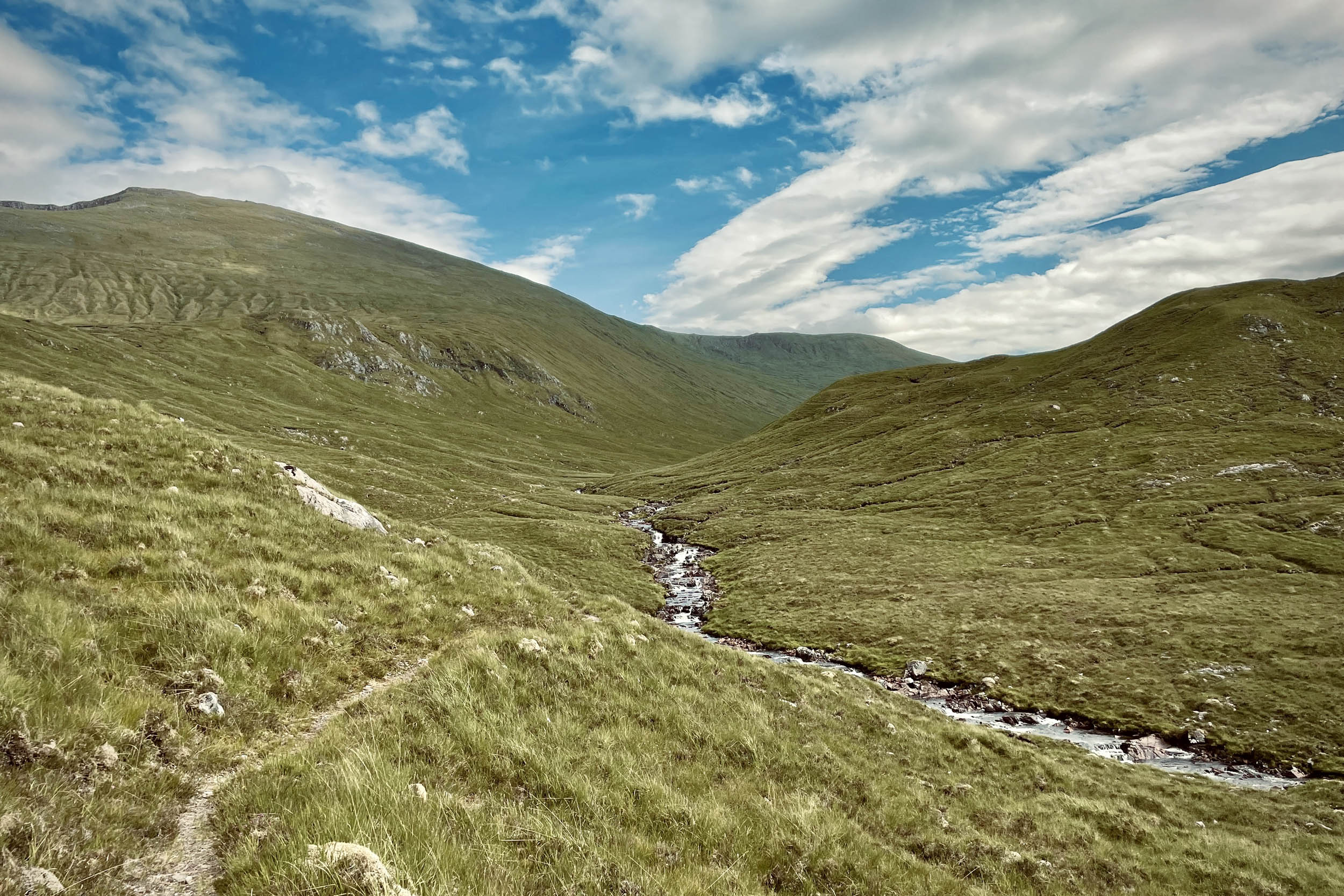
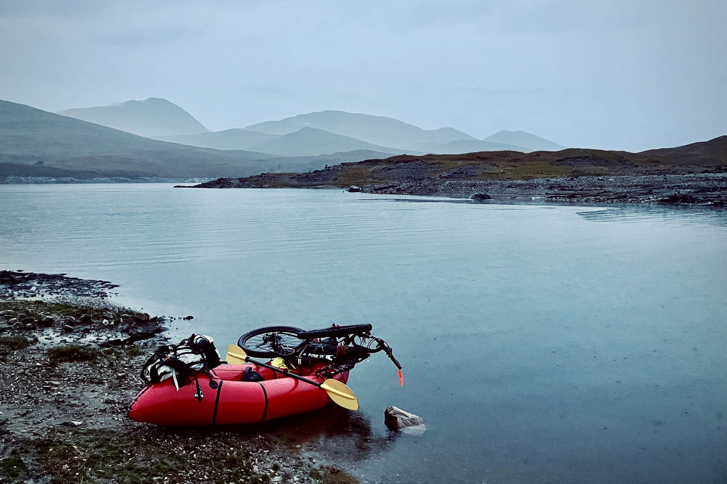
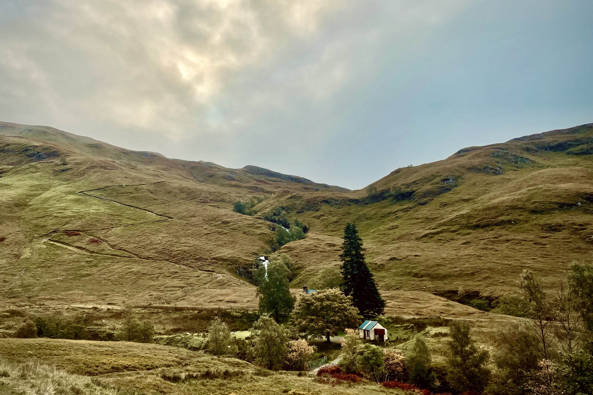
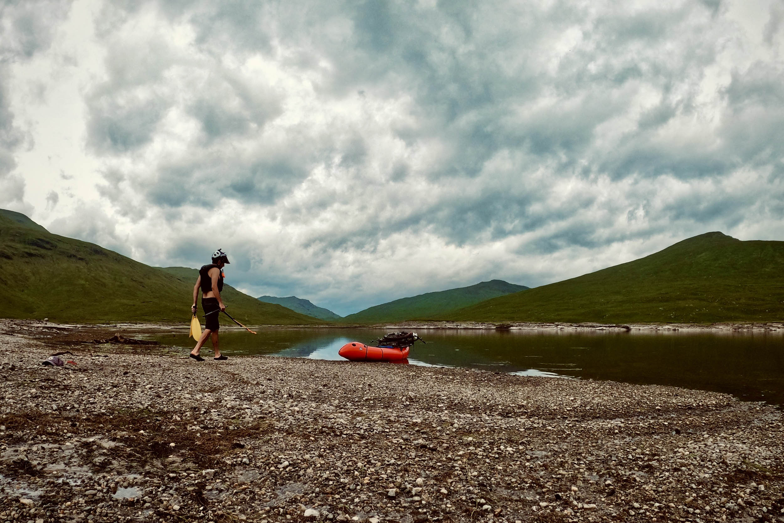
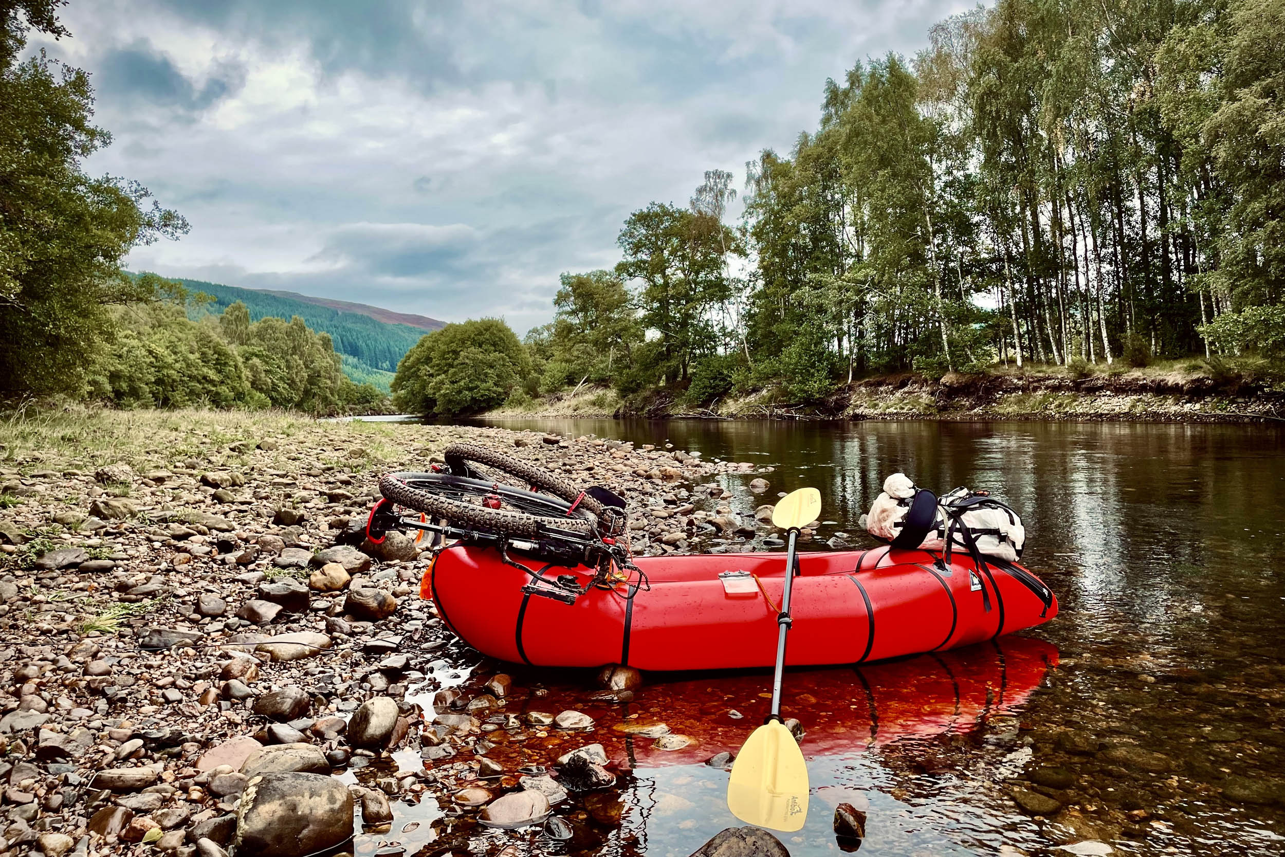
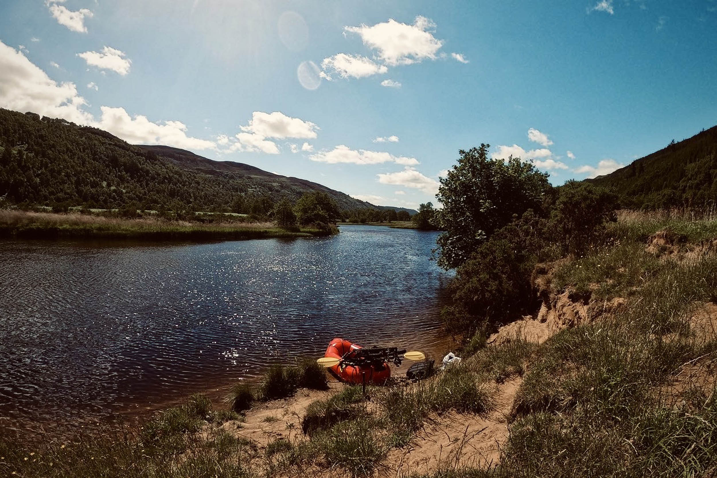
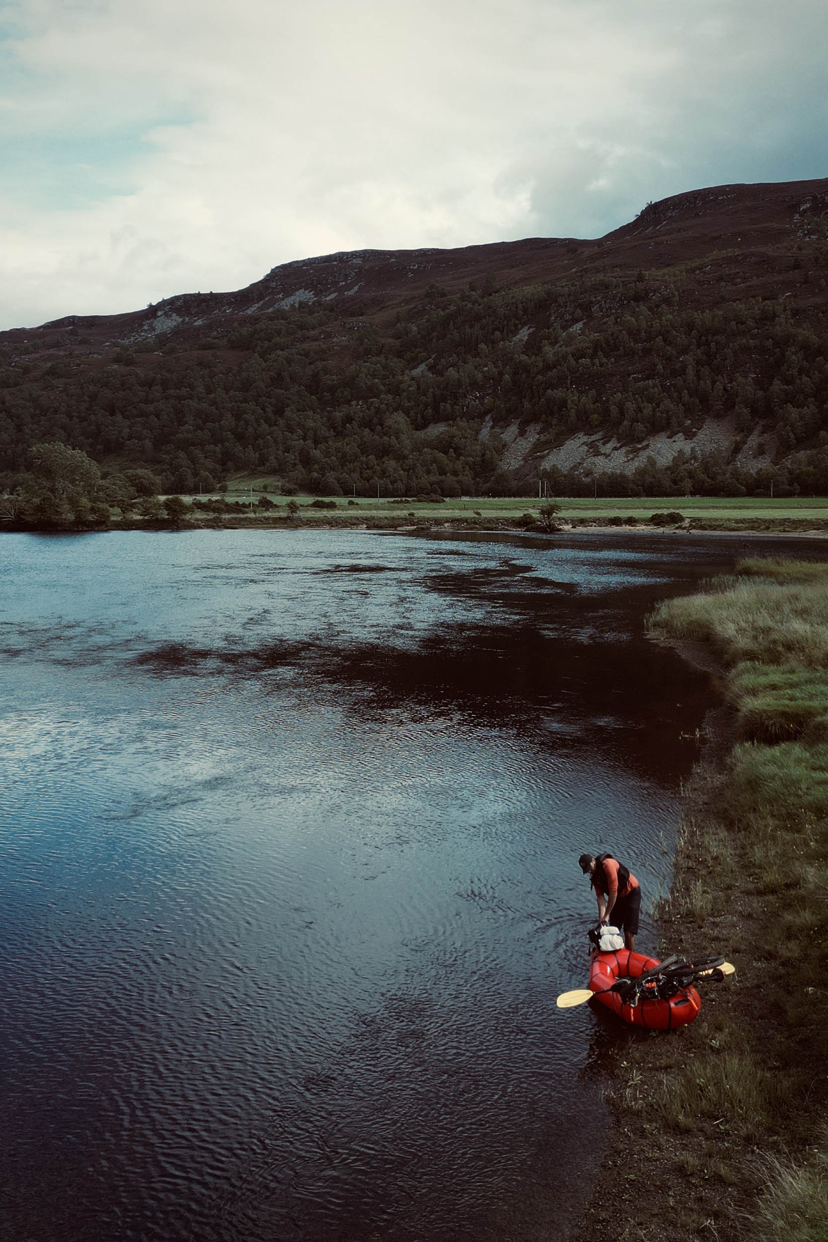
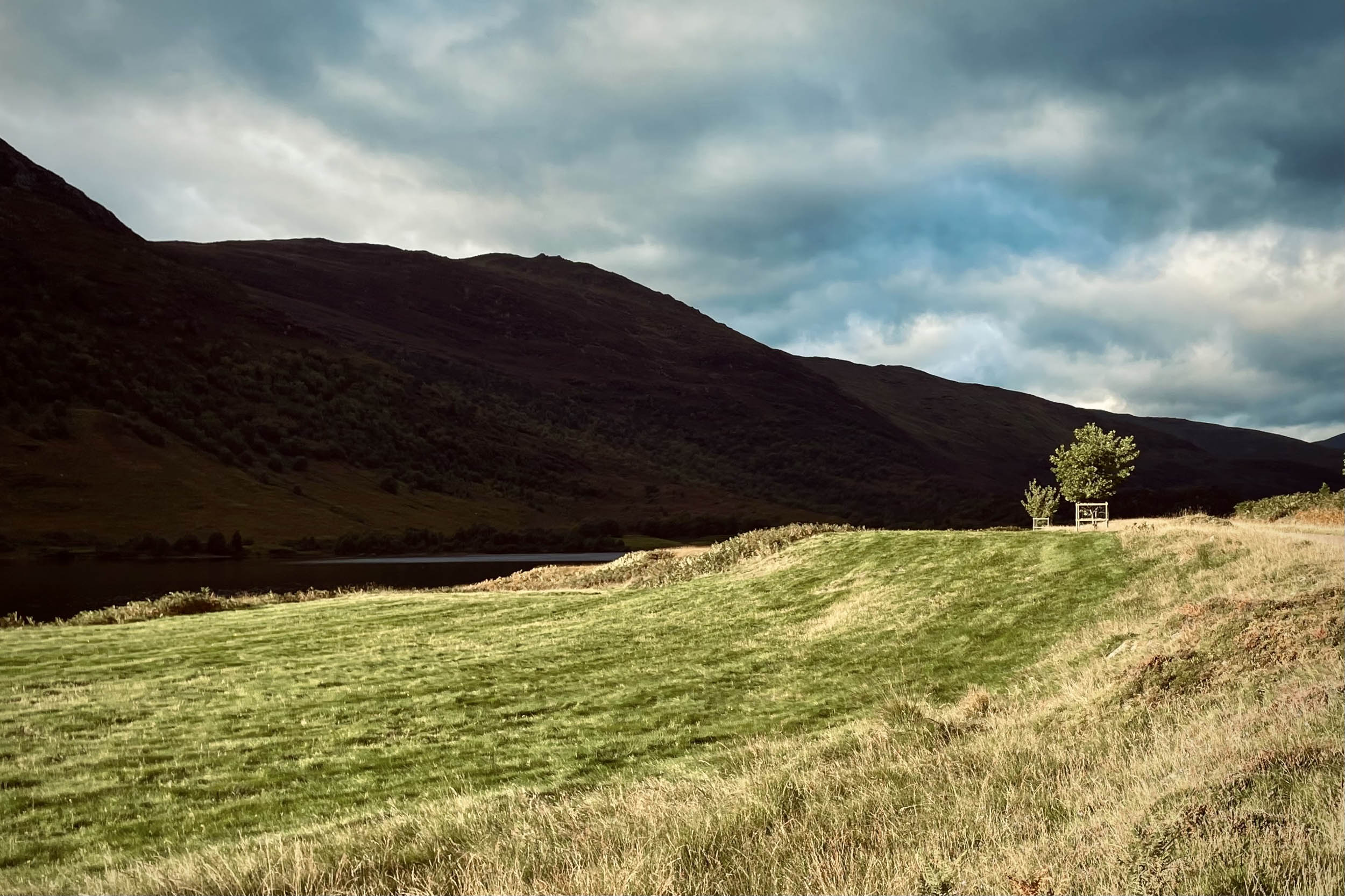
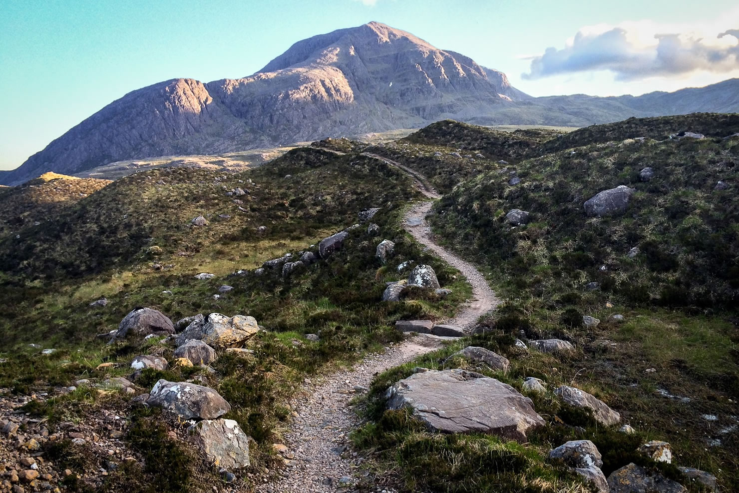
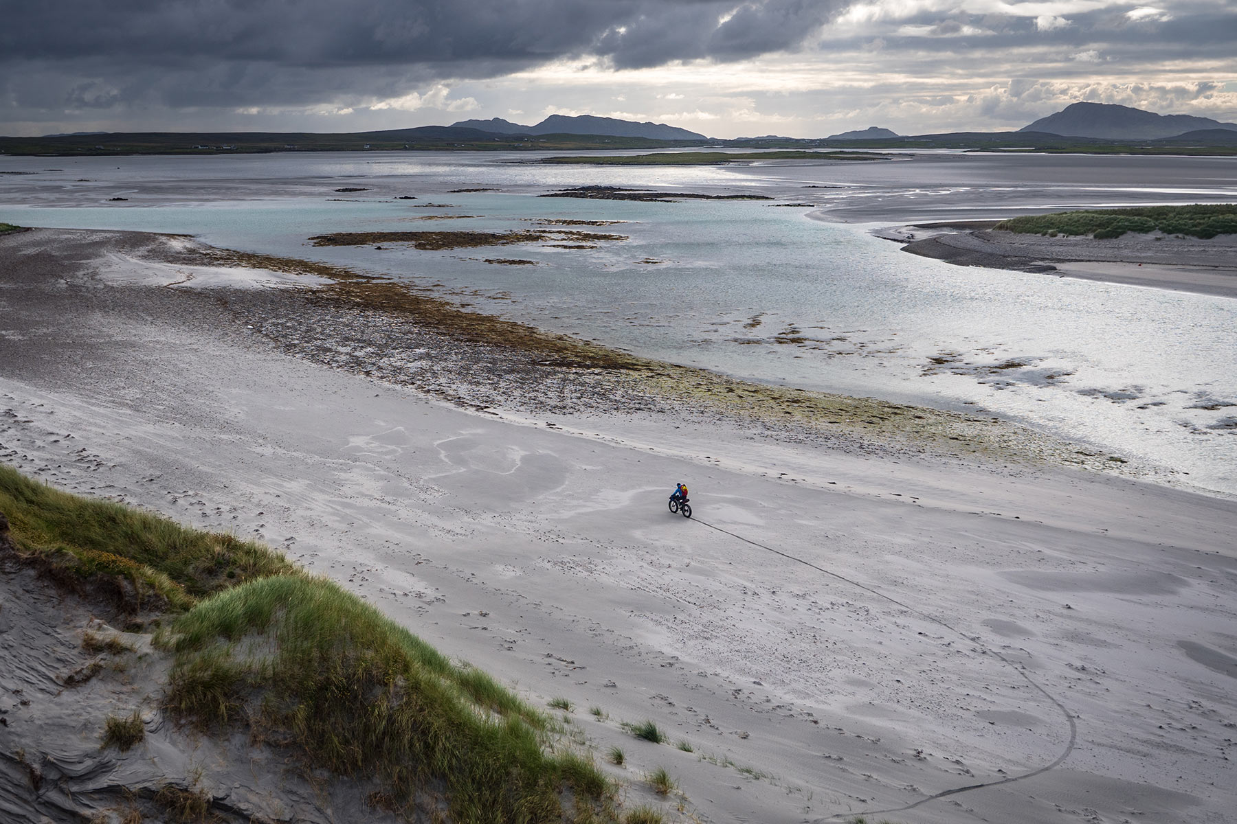
With more than 20,000 freshwater lochs and numerous sea lochs, Scotland is a perfect country for rafting. And with hundreds of miles of gravel roads and singletracks linking these lochs, it becomes an even better country for bikerafting. The Glenha Bikerafting Loop runs through Glen Strathfarrar and Glen Cannich and links them up by passing through the East part of Glen Elchaig.
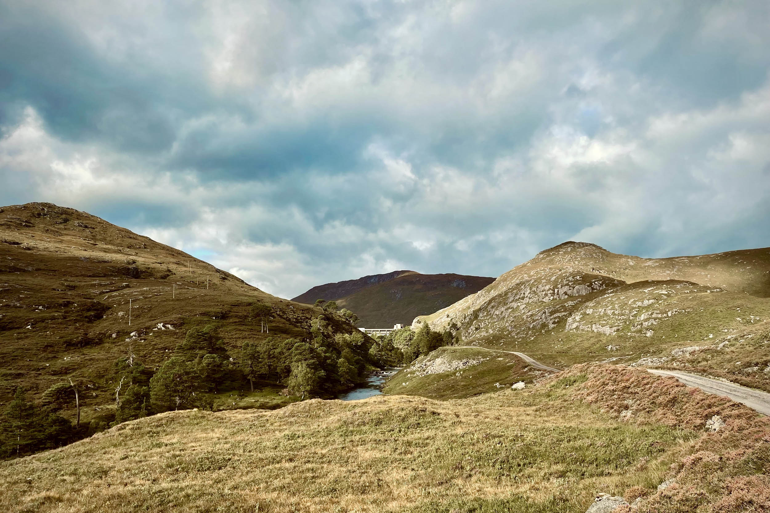
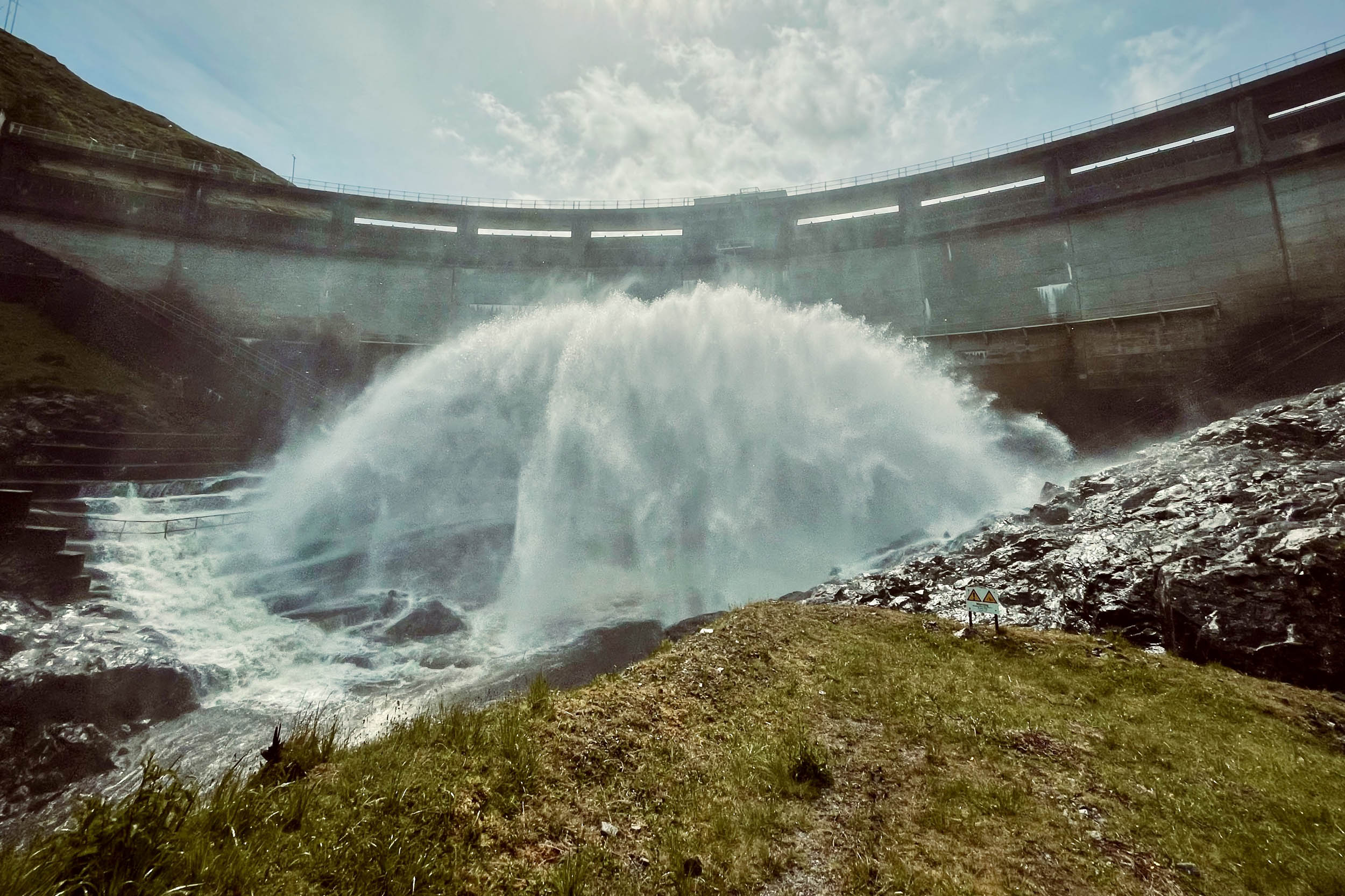
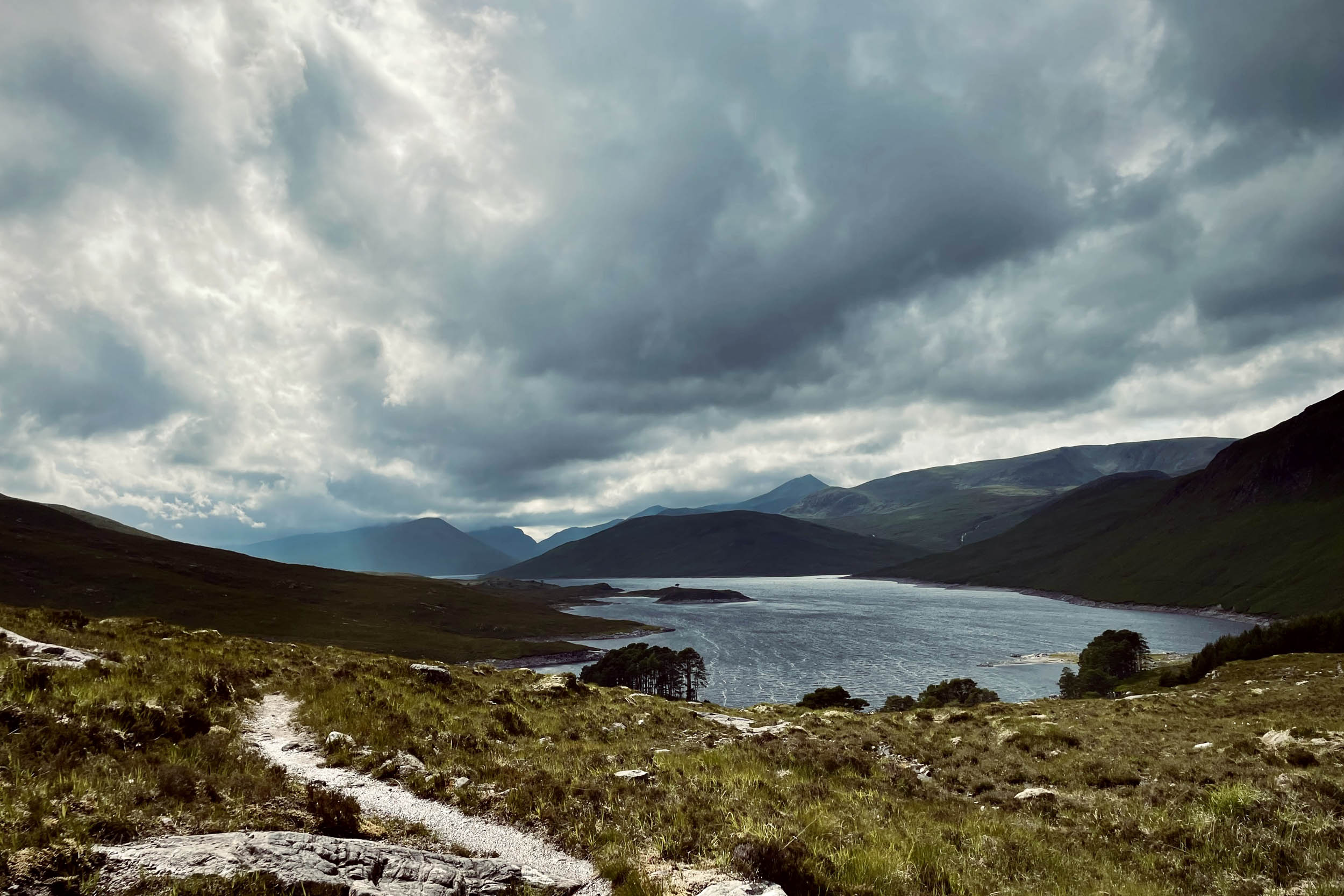
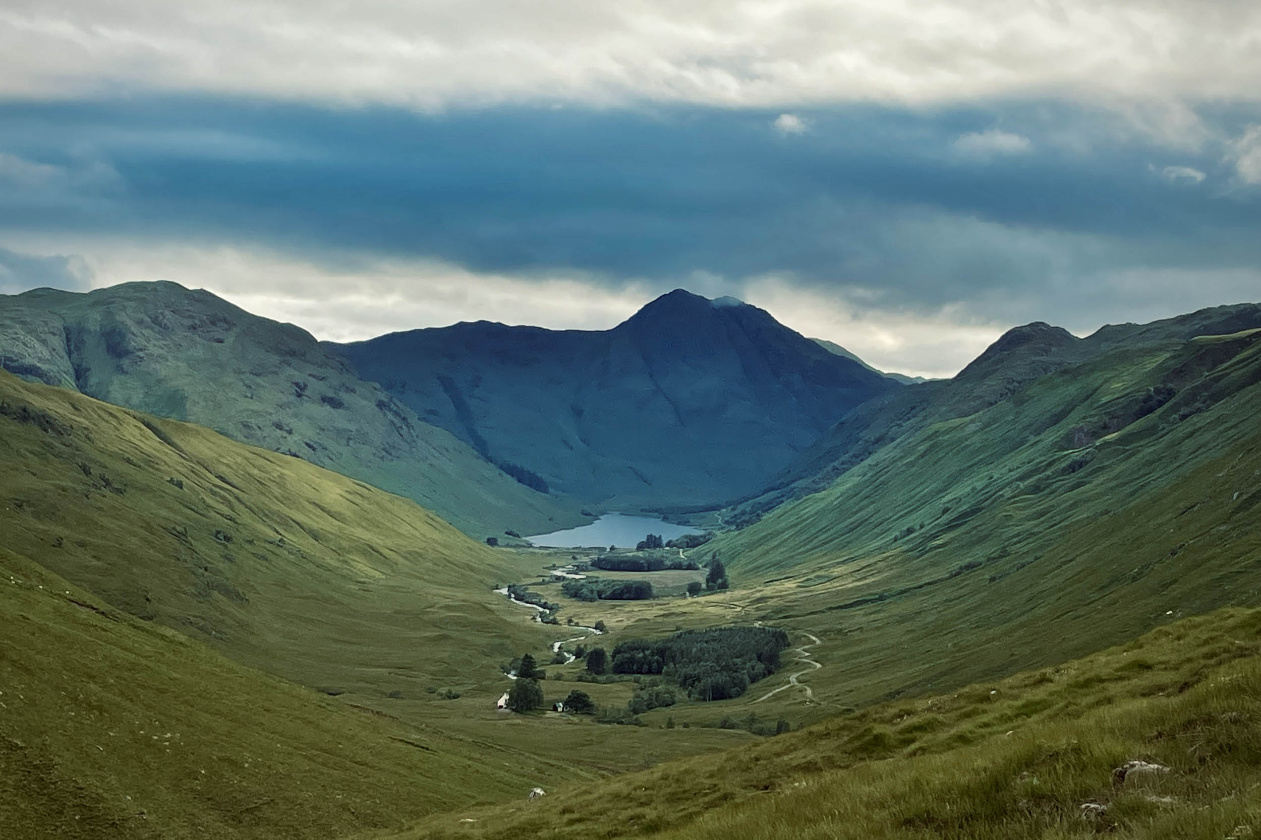
Glen Strathfarrar, like the neighbouring glens, is a haven for the outdoor enthusiast. The road into the glen is private, and access to motor vehicles is restricted, which makes it an excellent location for cycling. The lower part of Glen Strathfarrar, from Leishmore to Coille an Ath, was designated a National Nature Reserve in 1977. Like Glen Affric, the Strathfarrar pinewood is a remnant of the ancient Forest of Caledon. Further west, a deep gorge leads to the horseshoe-shaped Monar Hydro Dam. Beyond the dam is Loch Monar, surrounded by Munro peaks and forests.
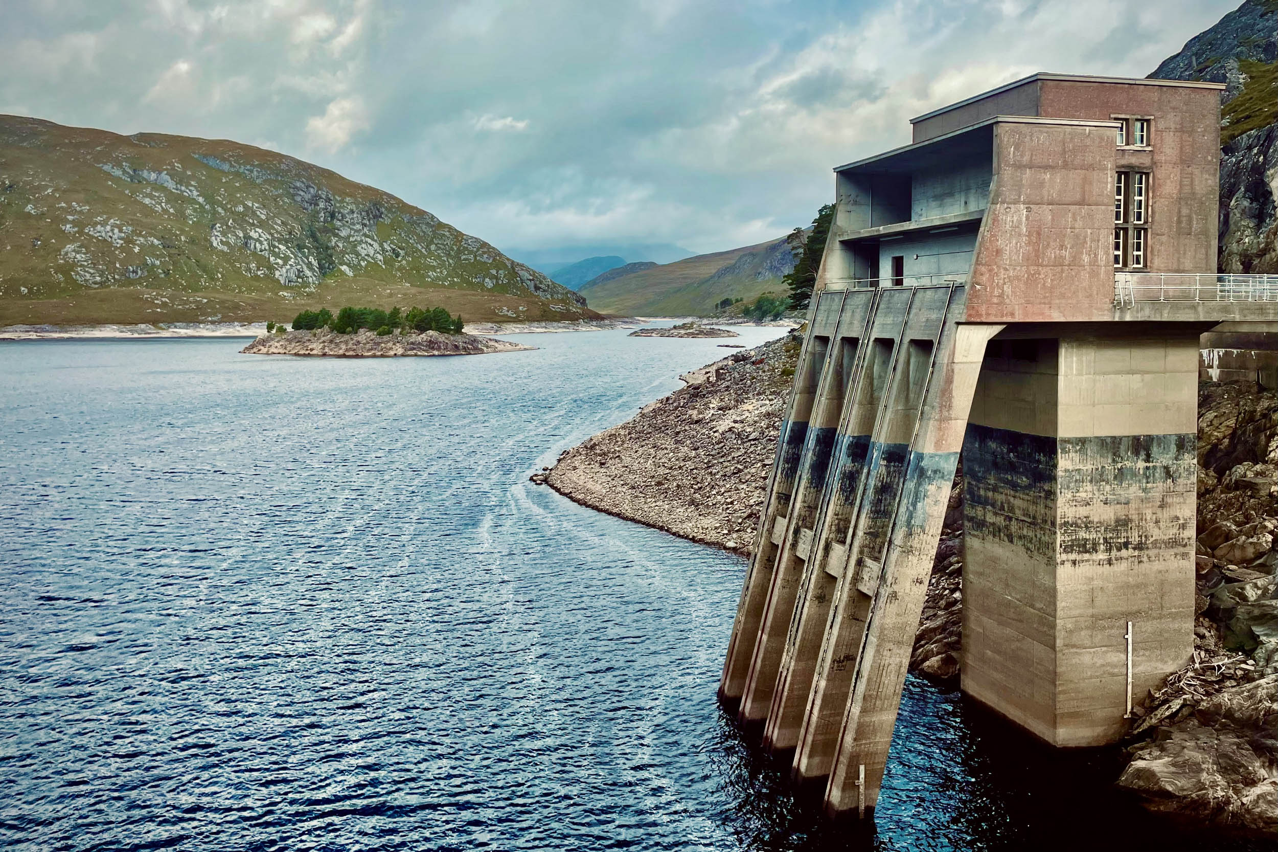
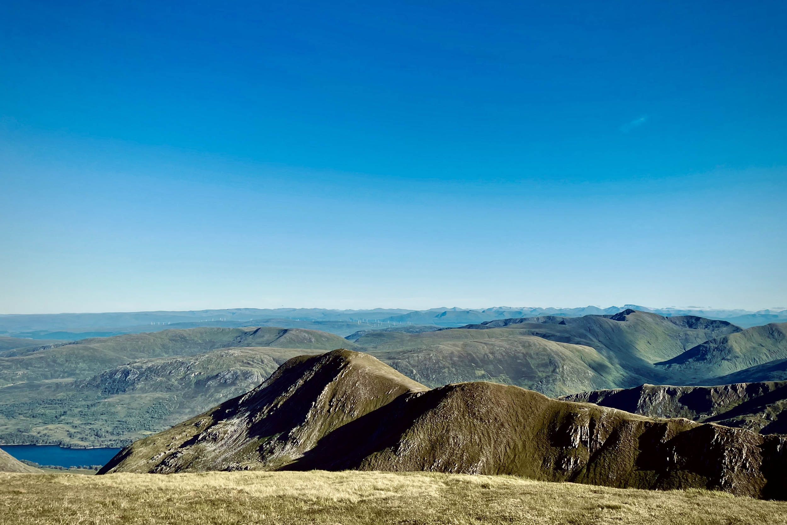
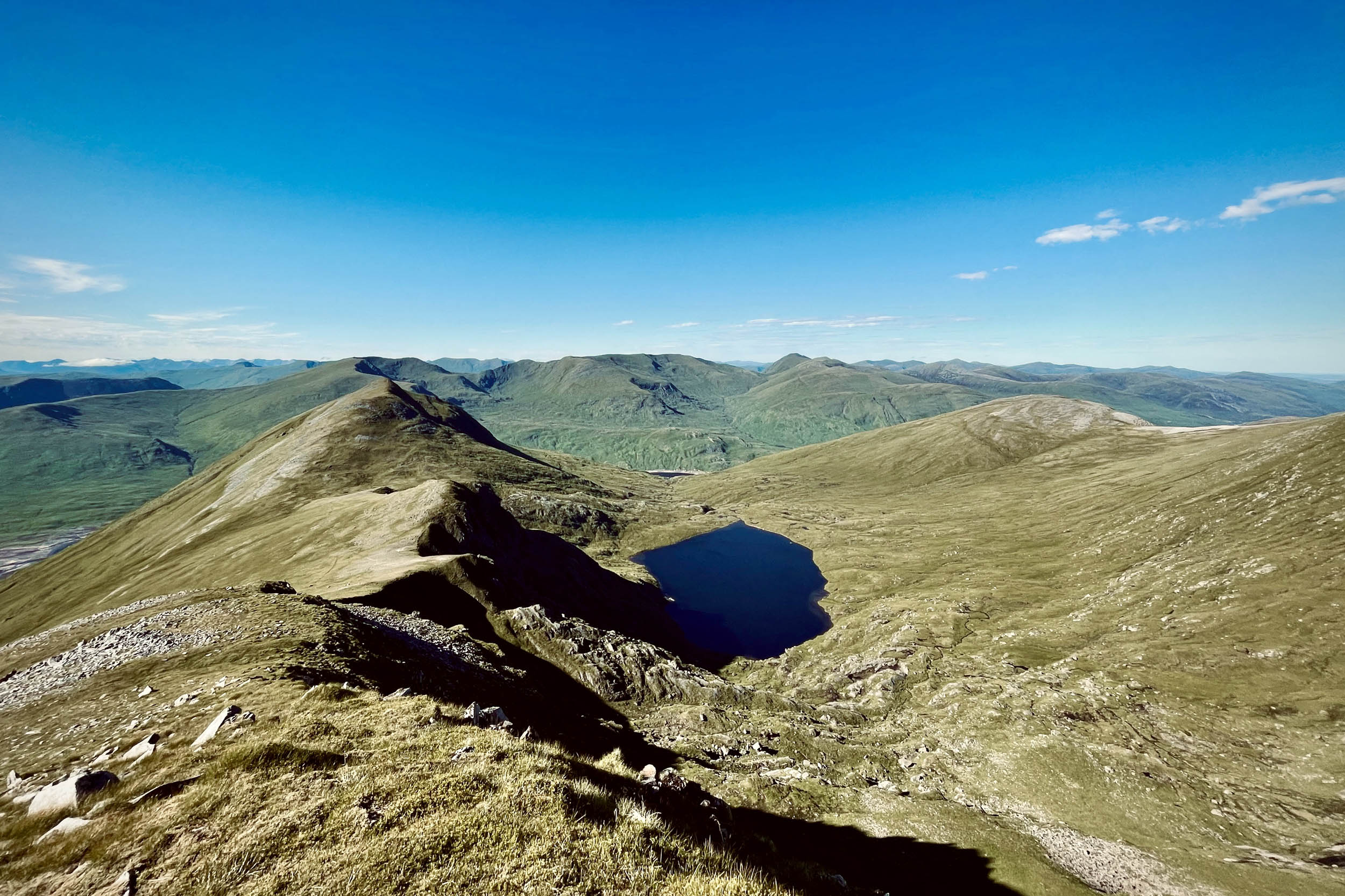
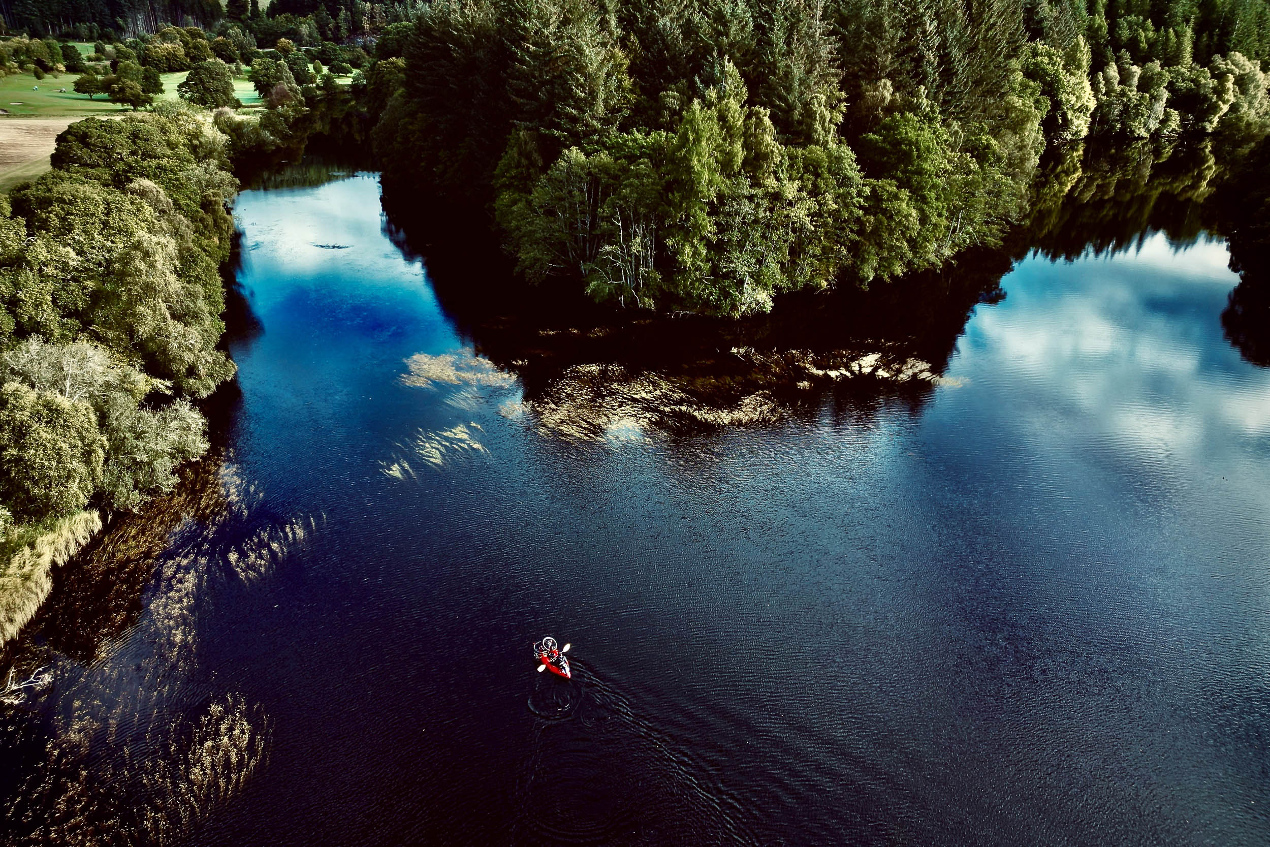
Glen Cannich is home to Mullardoch Dam, the largest dam in Scotland, with the structure stretching half a mile. Less frequented than its close neighbours, Glen Affric and Glen Strathfarrar, Glen Cannich has much to offer in terms of wild mountain scenery. Loch Mullardoch stretches for some 10 miles with west-to-east prevailing wind. Following the suggested direction of this loop provides an excellent sailing experience. Glen Cannich offers superb hillwalking, with several Munros on both sides of Loch Mullardoch. Those on the south side are now most often climbed from Glen Affric, with the possible exception of Beinn Fhionnlaidh, which is more accessible from Glen Cannich.
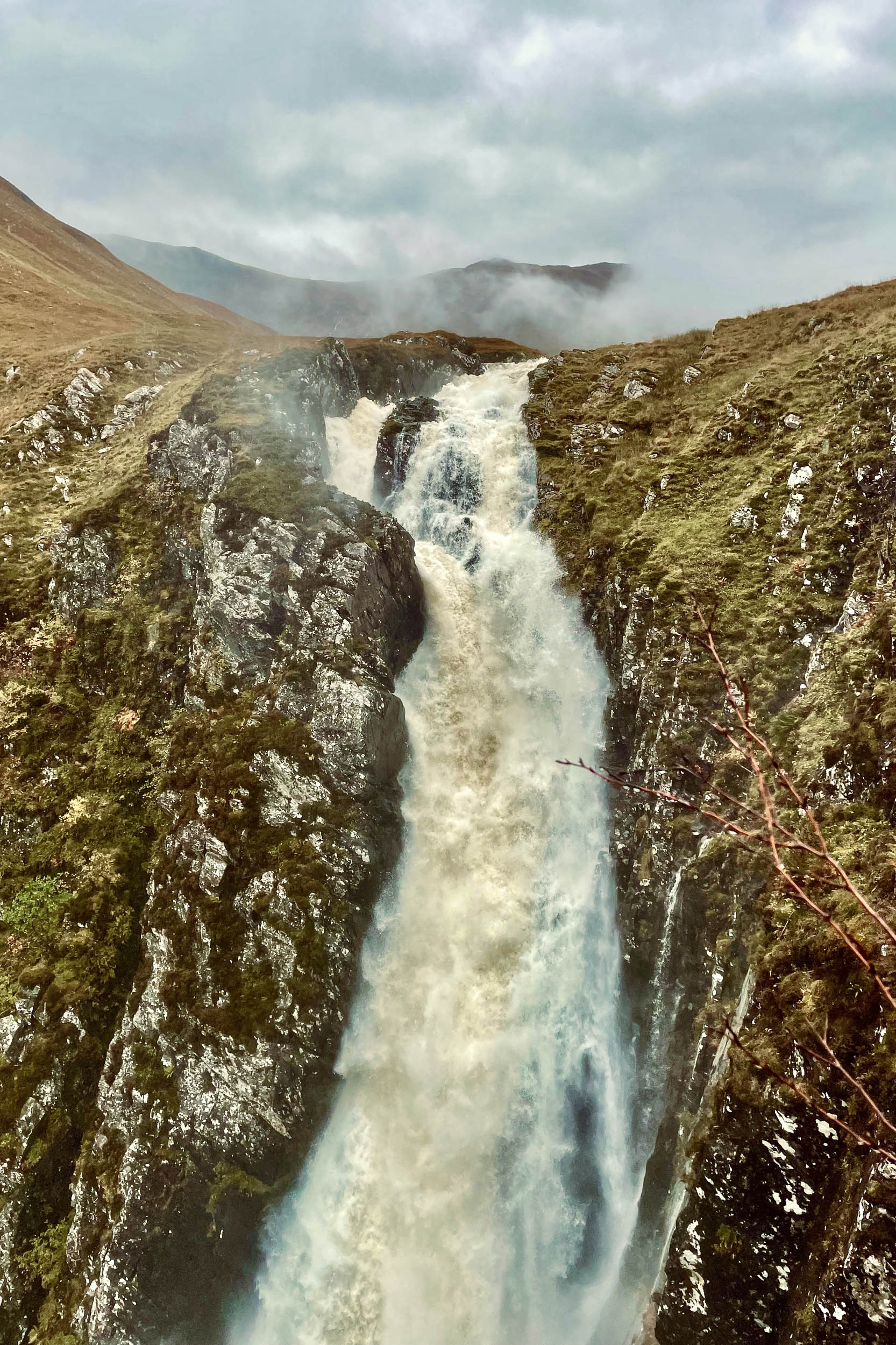

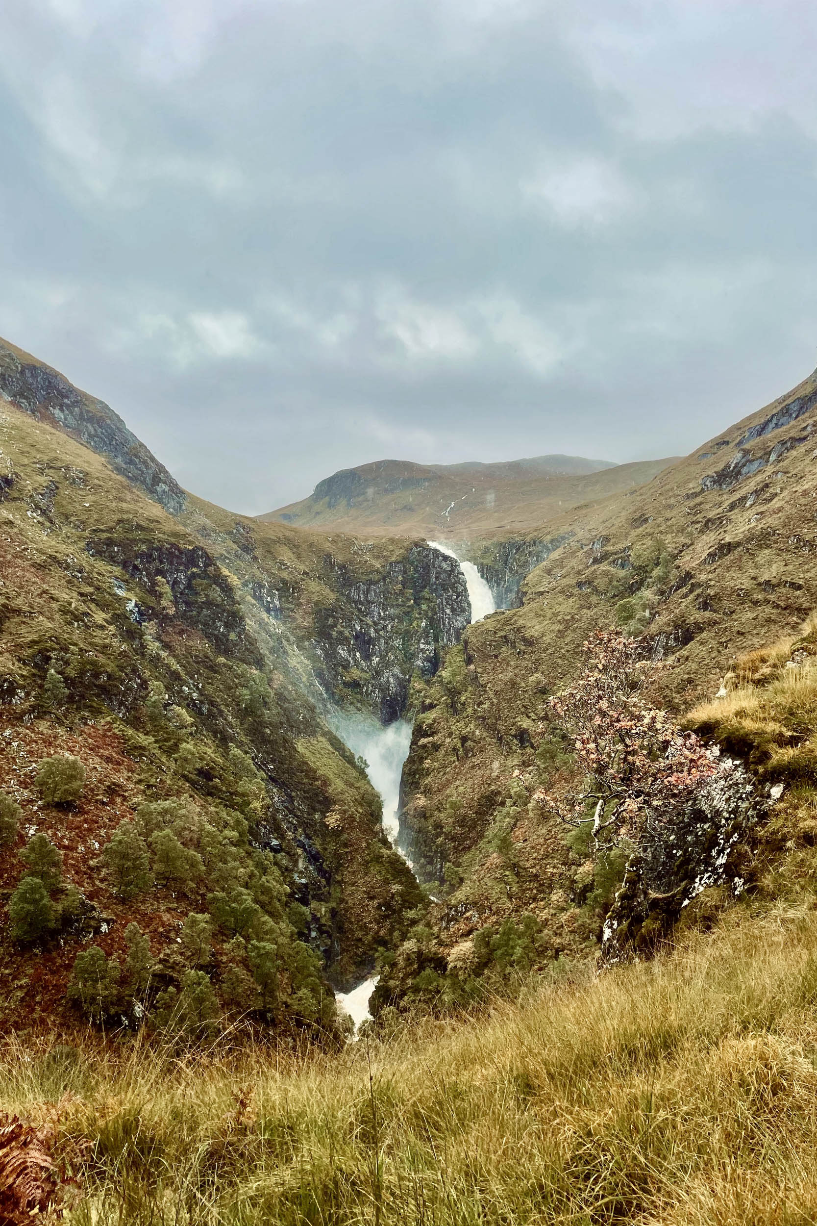
Glen Elchaig, at the westernmost part of the trail, is another beautiful but less visited part of Scotland. The Falls of Glomach, easily accessible from this glen, are among the highest waterfalls in Britain. Doing this loop offers an excellent opportunity to visit this remote and spectacular waterfall.
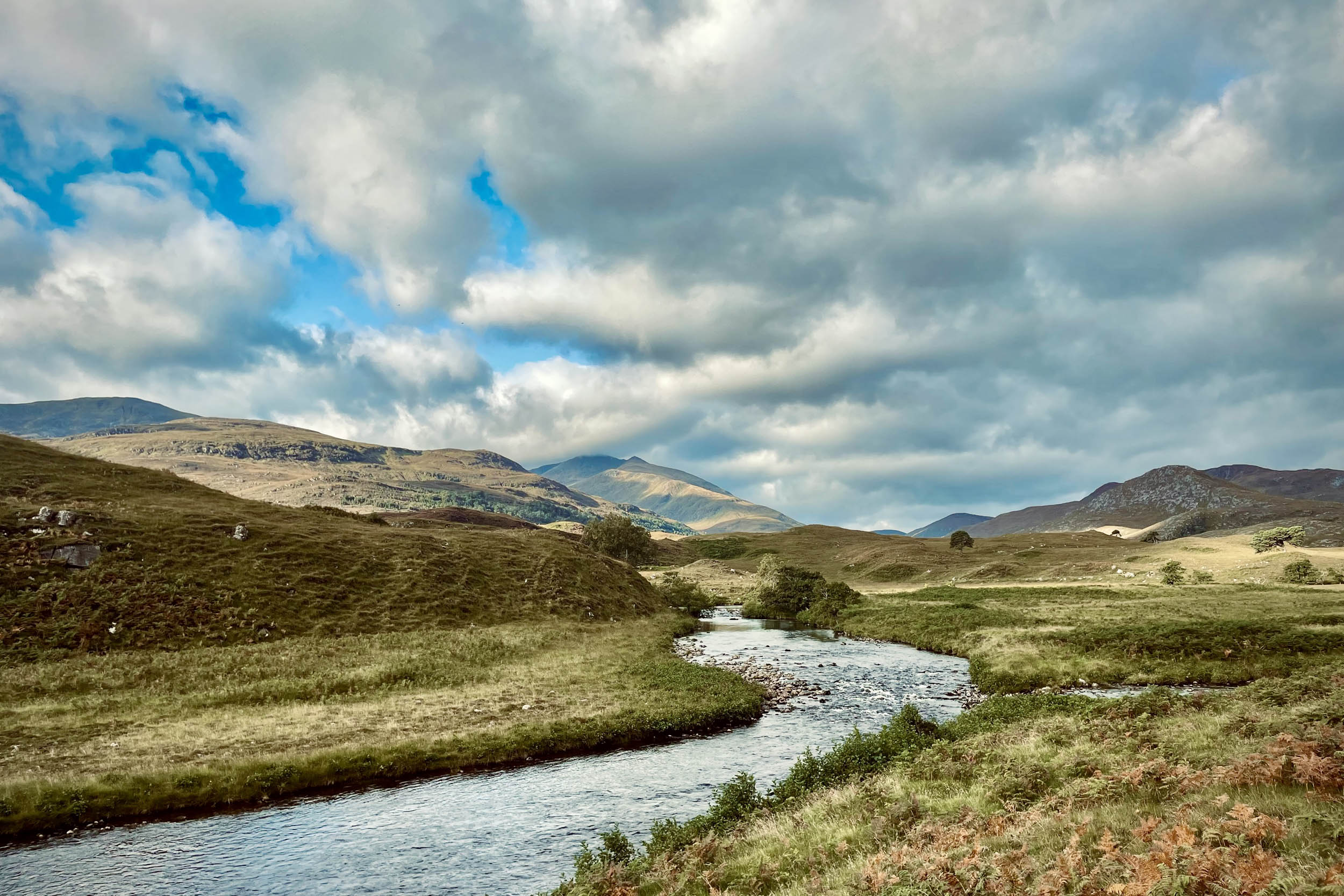
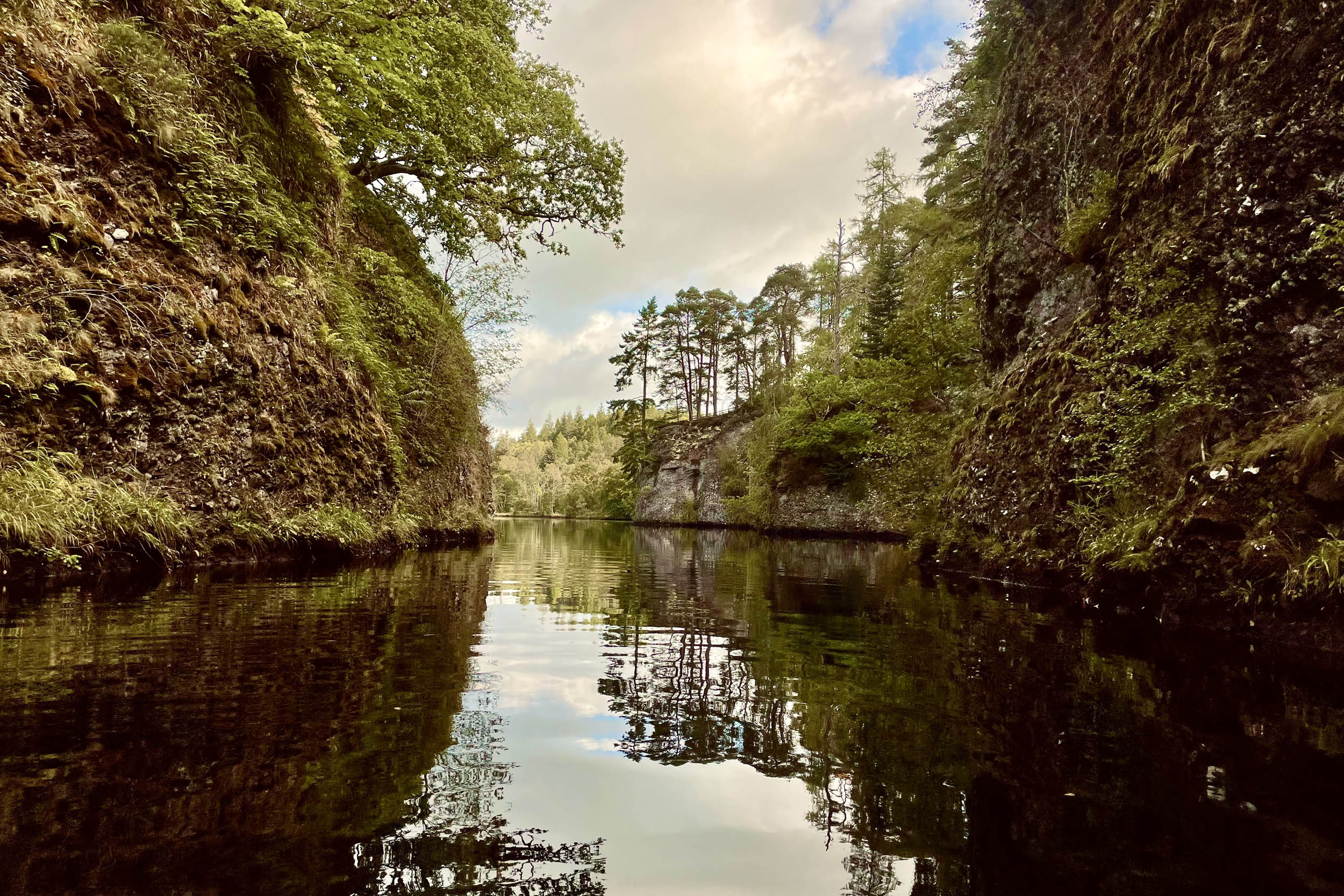
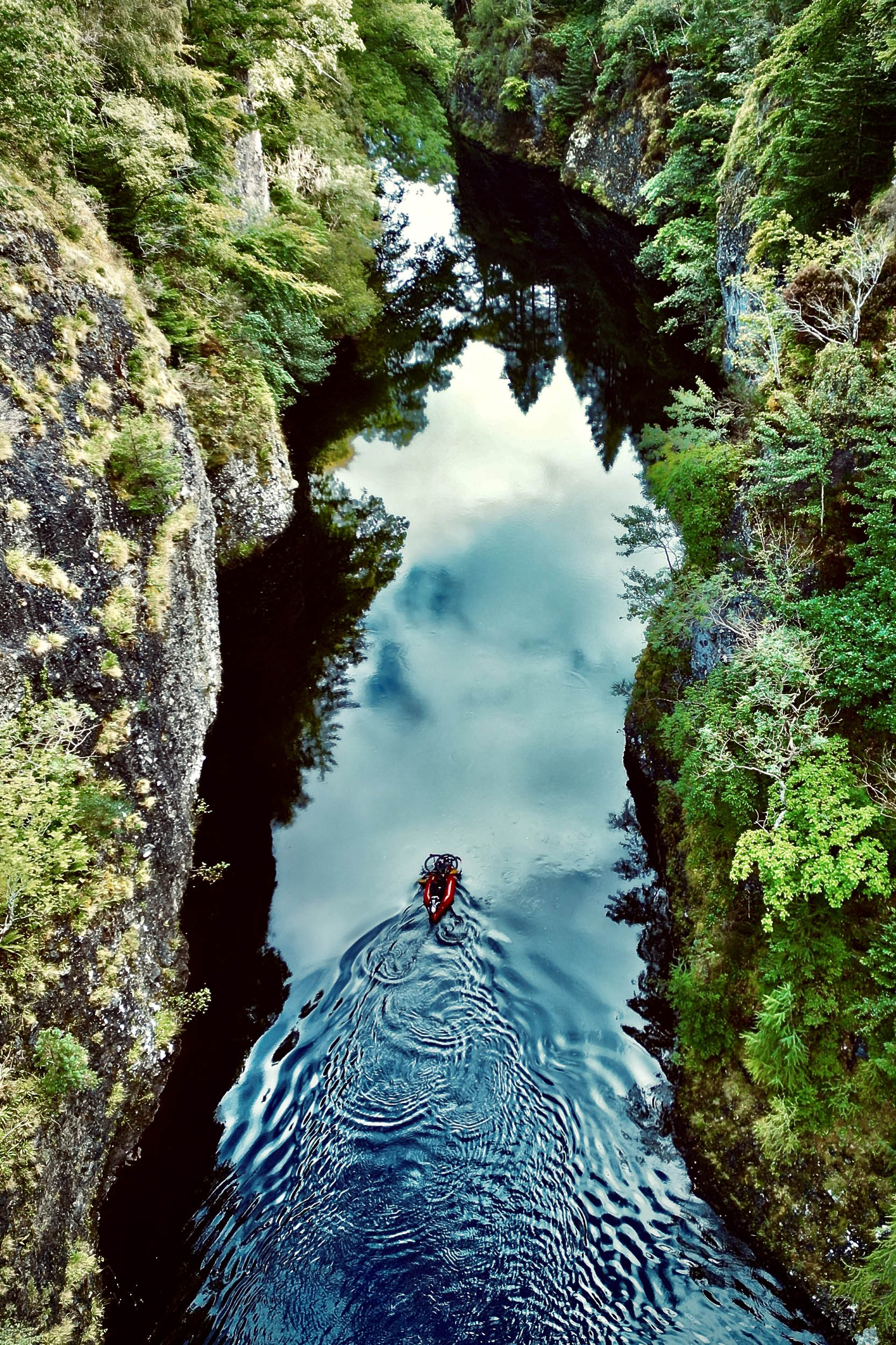
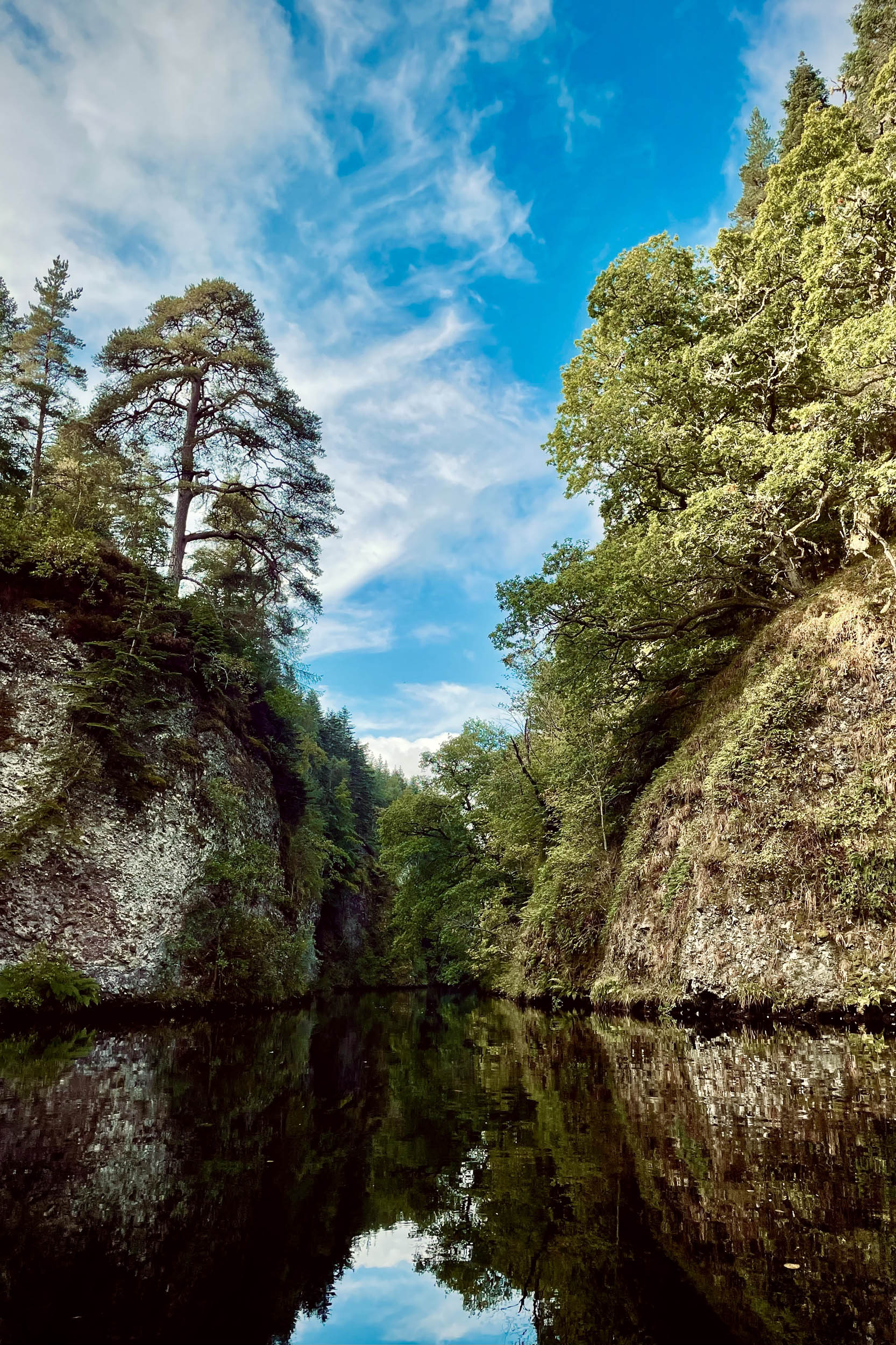
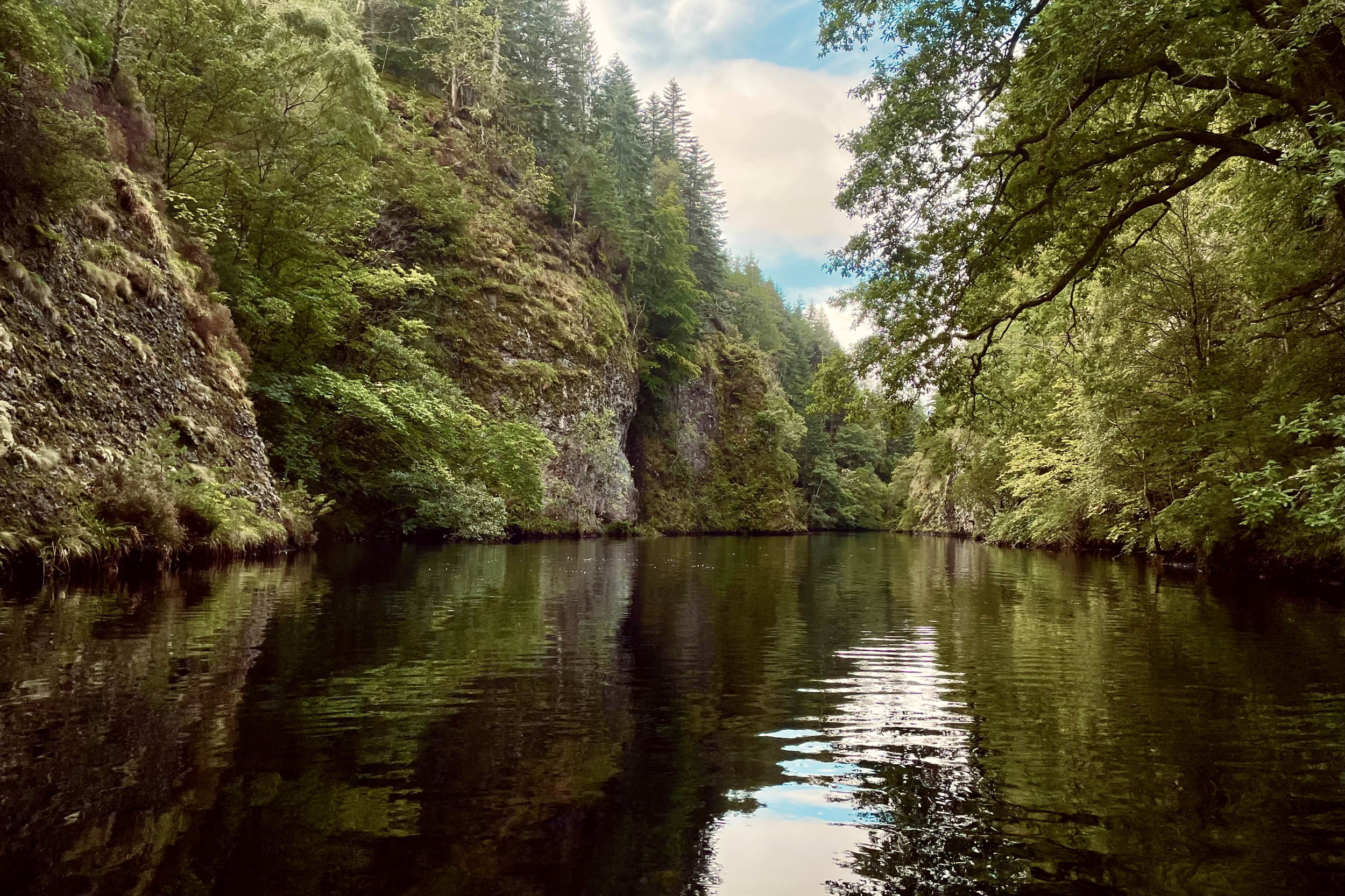
Rivers Cannich and Farrar are outflows of Lochs Mullardoch and Monar. Farther down, these rivers join forces with River Glass to create the mighty River Beauly, which will carry you down to Aigas Gorge, one of the most scenic sections of the route. Aigas Gorge is a popular location for kayaking and canyoning trips.
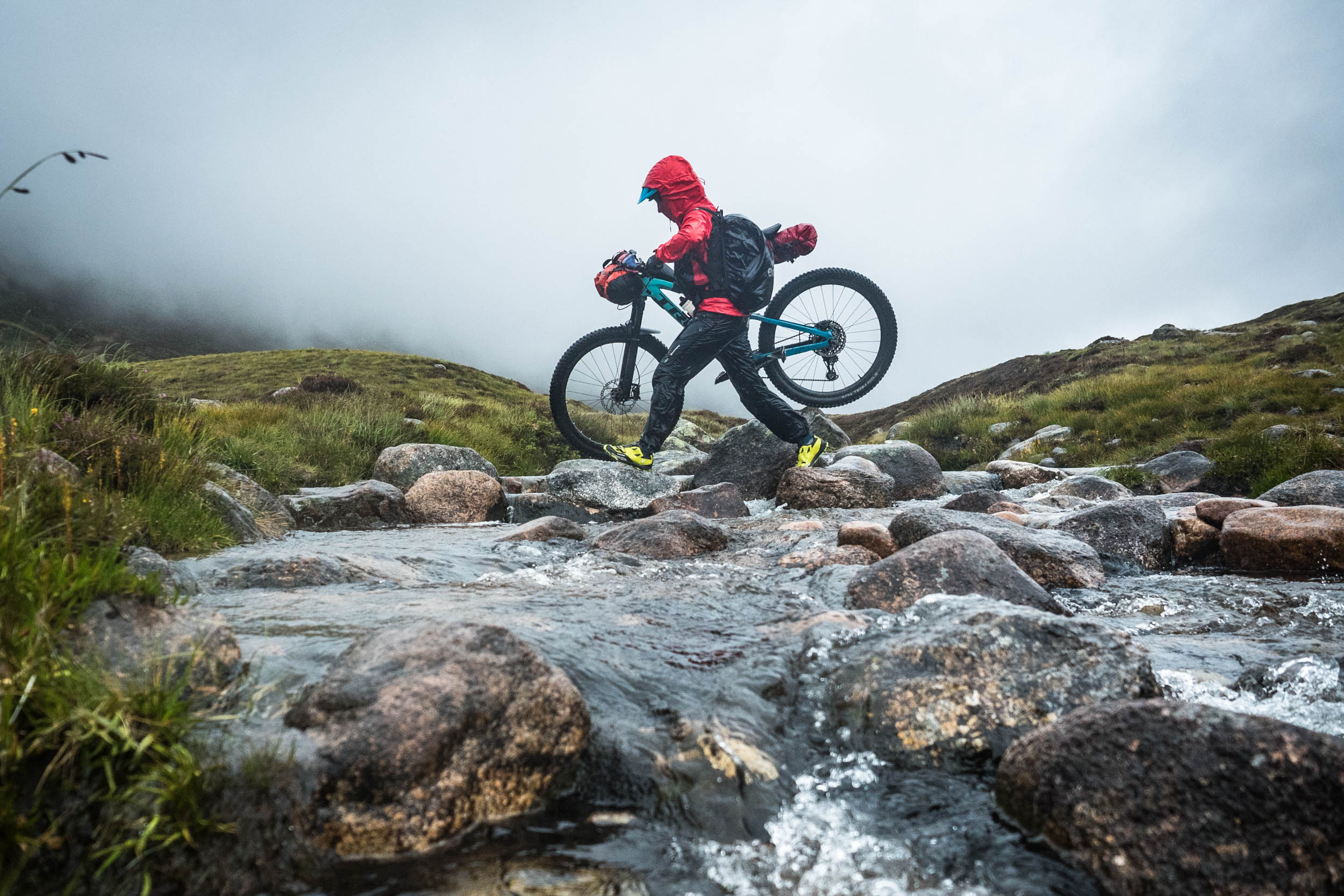
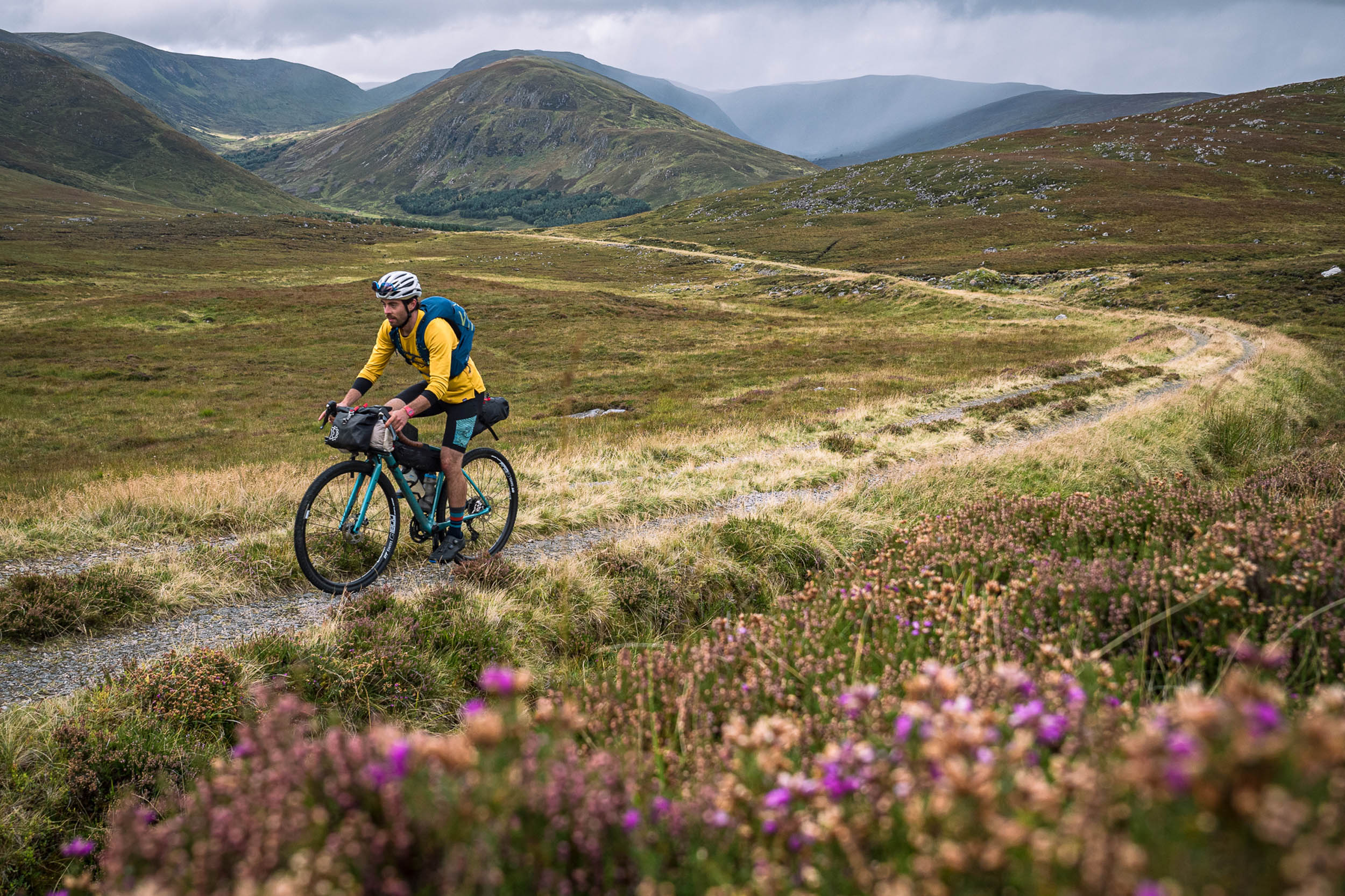
Cycling/rafting the Glenha Bikerafting Loop is a challenging adventure, but the reward is great. Riders will find themselves immersed in some of the most remote Highland landscapes in the country.
Route Difficulty
This route has an overall difficulty of 8 out of 10. Physical Demand (8): With a max gradient of 22.9%, this route has 7,838 feet (2,389 metres) of climbing over 115 miles (185 kilometres), which means approximately 68 feet per mile (13 metres per kilometre). A large portion of these climbs are over paved roads. However, carrying the extra weight of a packraft and rafting equipment makes the climbs physically challenging. Paddling the lochs and rivers also makes this loop physically demanding. Technical Difficulty (8): Rafting makes this route technically difficult; careful planning and preparation are essential to make the rafting safe. A total of 16 miles (26 kilometres) of singletrack also gives another technical challenge to this route. Resupply and Logistics (7): A large portion of the loop is in a very remote area with no possibility of quick exit.
Route Development: My work on the Glenha Bikerafting Loop started in the summer of 2022 as a solo project. Being fascinated by the beauty of Glen Affric, I was keen to explore its neighbouring glens. During my initial research, it was soon obvious that existing trails disappear and don’t make it to the other side of the hills/lochs, or if they do, this comes at the cost of pushing and carrying your bike for hours. It was then that I packed my raft. After a lot of pre-ride research, particularly to ensure the safety of rafting segments, I cycled, paddled, and explored the entire loop in a week-long trip, during which I also climbed the suggested Munros. Following further trips, I added the optional diversion to Maol Bhuidhe bothy and safe take-out spots from River Beauly before entering the Aigas Gorge. I also explored paddling along and across Loch Monar from different put-in spots and the optional diversion to visit the Falls of Glomach. The option to exit the loop from Iron Loge was also established during one of my trips to the area, and I have followed the suggested hiking routes up the Munros in winter and summer. Photos are from several trips I have made to create this loop.
The name of this loop, Glenha, is a mix of Scottish and Persian languages. In Persian, “ha” is the plural suffix.

Submit Route Alert
As the leading creator and publisher of bikepacking routes, BIKEPACKING.com endeavors to maintain, improve, and advocate for our growing network of bikepacking routes all over the world. As such, our editorial team, route creators, and Route Stewards serve as mediators for route improvements and opportunities for connectivity, conservation, and community growth around these routes. To facilitate these efforts, we rely on our Bikepacking Collective and the greater bikepacking community to call attention to critical issues and opportunities that are discovered while riding these routes. If you have a vital issue or opportunity regarding this route that pertains to one of the subjects below, please let us know:
Highlights
Must Know
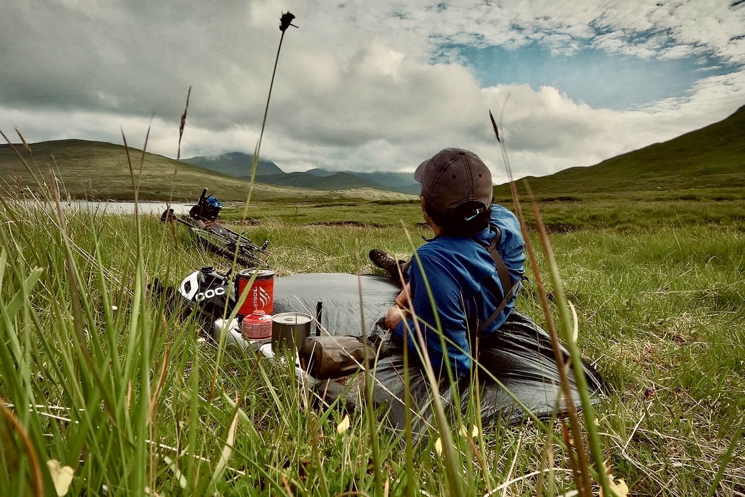
Camping
Food/H2O
Trail Notes
Resources
- Glen Elchaig: After passing Loch Mhoicean, the descent to Glen Elchaig has a breathtaking view.
- River Glass and River Beauly: You will witness some of the best autumnal views of your life by rafting these rivers in fall.
- Aigas Gorge: Rafting through Aigas Gorge is a unique experience. Sightings of ospreys and red kites are common in this area.
- Mullardoch Dam is the largest dam in Scotland
- Monar Dam is the largest arch dam in the UK.
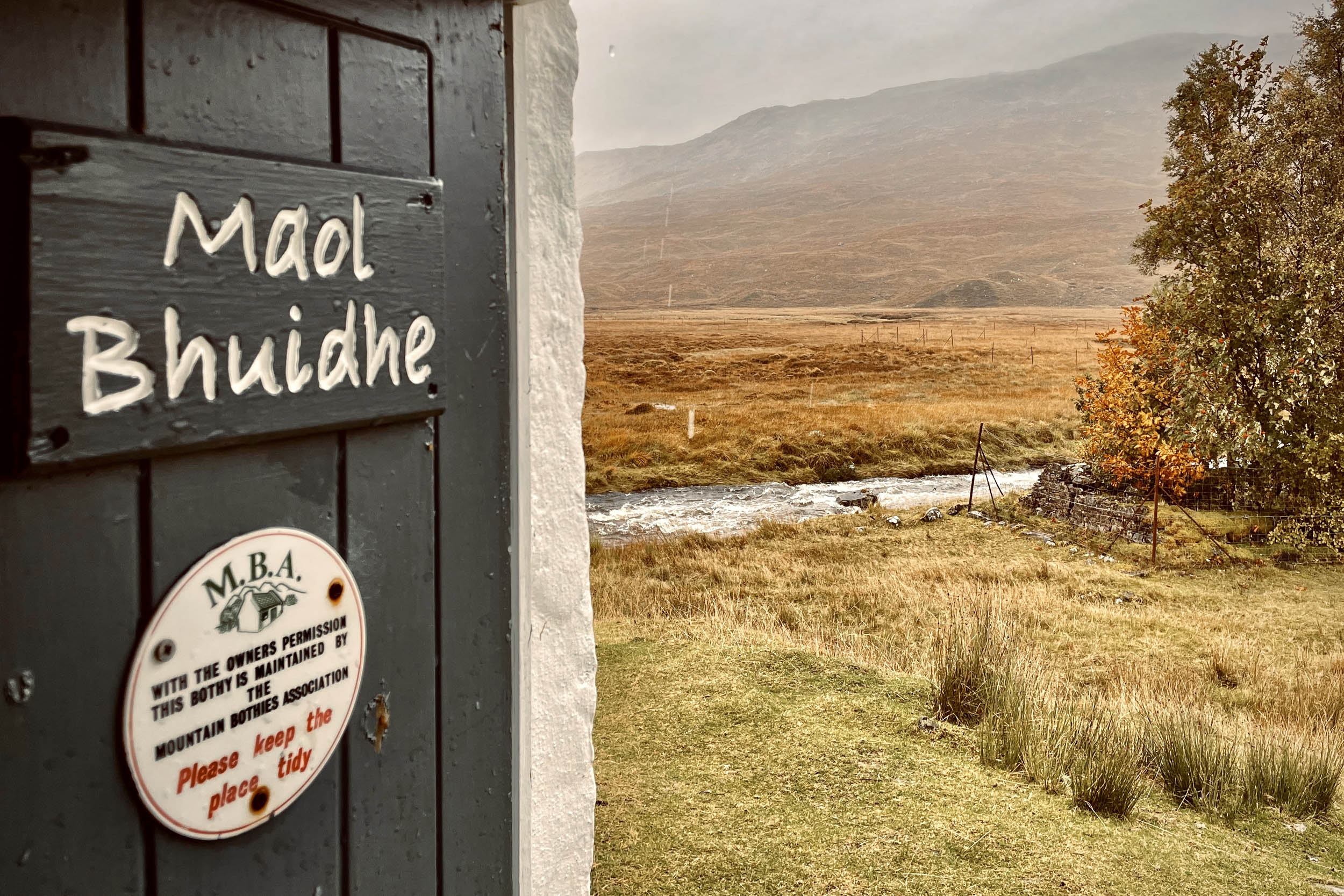
- Maol Bhuidhe Bothy is one of the most remote bothies in the UK.
- Falls of Glomach: One of the most magnificent waterfalls in Scotland, with a single drop of 113 metres (370 feet). Glomach is also known as being one of the most remote waterfalls in Scotland (to get to the waterfall and back requires hours of walking from the nearest road). With this route taking you through Glen Elchaig, this is your best opportunity to visit this waterfall. From the Iron Lodge, cycle southwest for 1.24 miles through the glen until you reach another lodge called Carnach, take the singletrack on your left for 1.36 miles to walk to the falls. Find the map to this short ride and the hike via this link. In the photo gallery, you will find the photos of the waterfall.
- The Munros: This route is a great opportunity to climb some of Scotland’s more difficult-to-reach Munros, which otherwise have very long walks in and out. Beinn Fhionnlaidh, Carn Eige, and Mam Sodhail are highly recommended. In the photo gallery, you’ll find the photos of the views from the tops. Here is the map link to this hike.
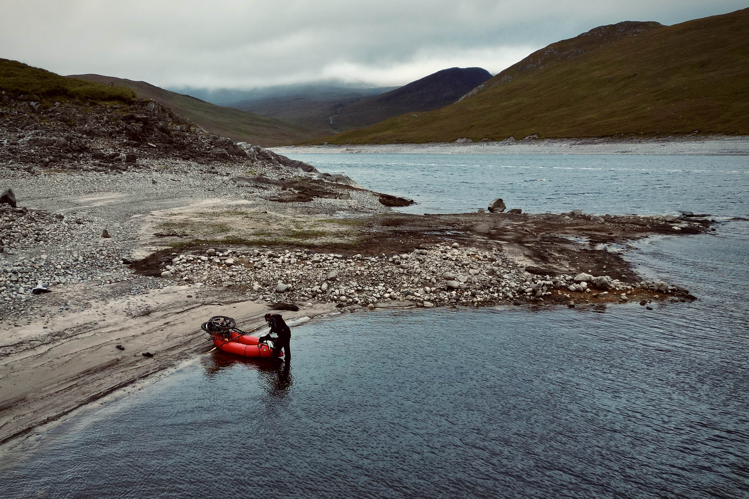
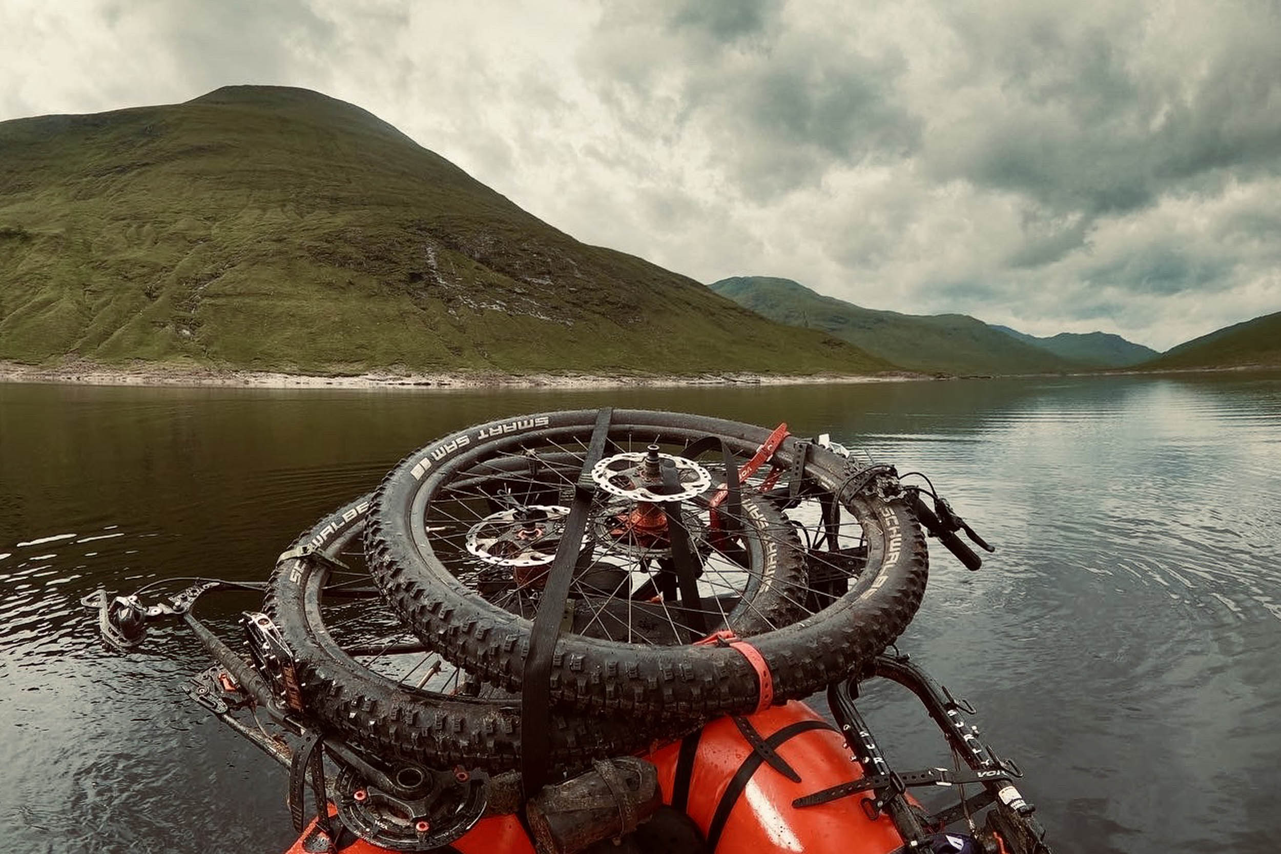
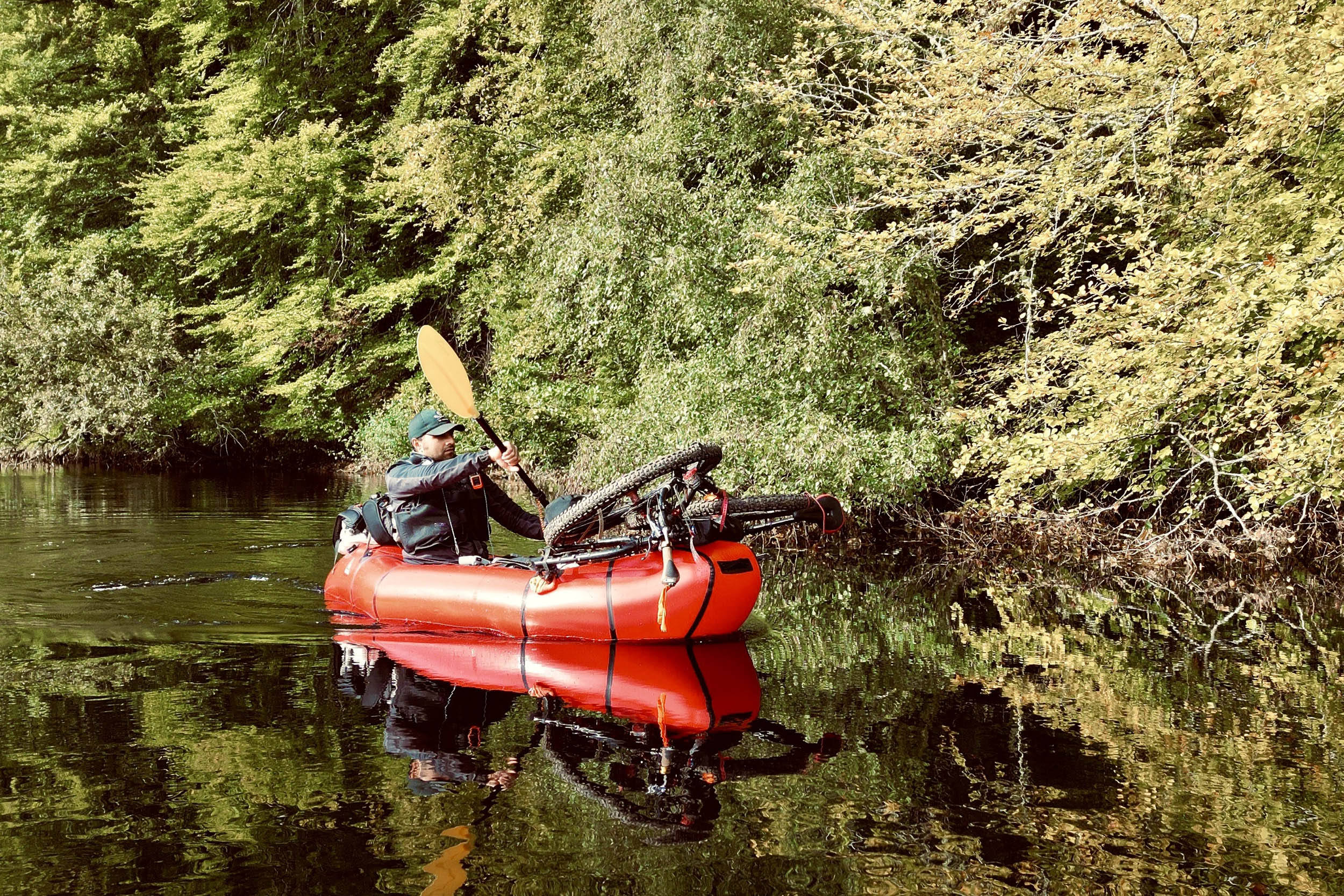
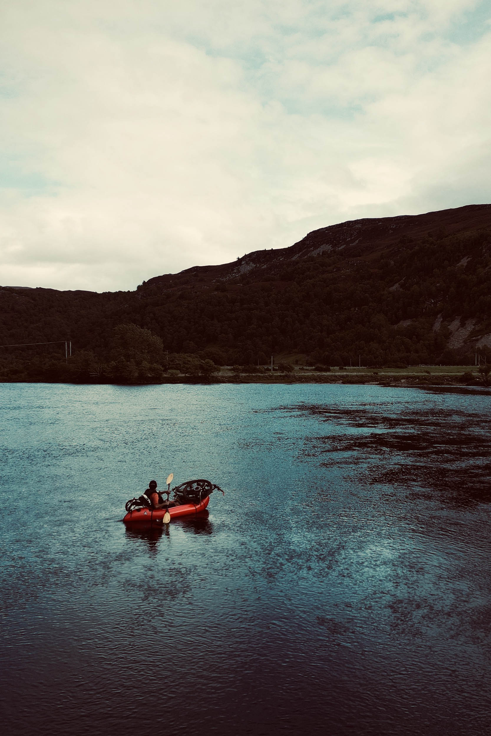
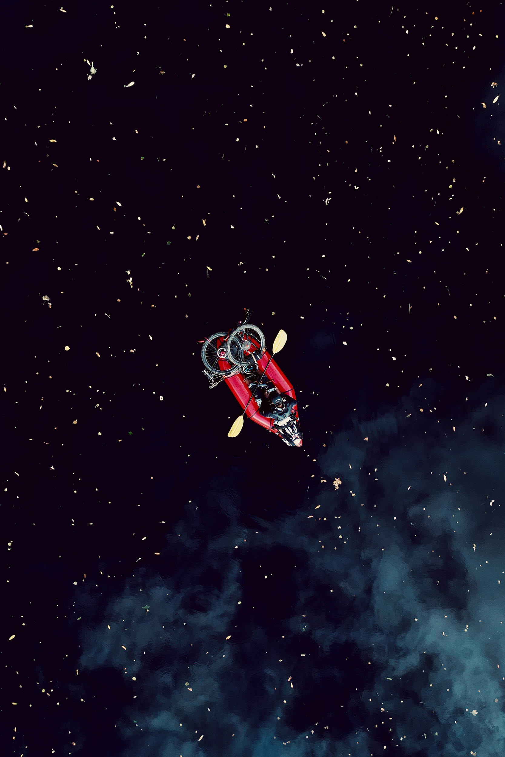
Bikerafting
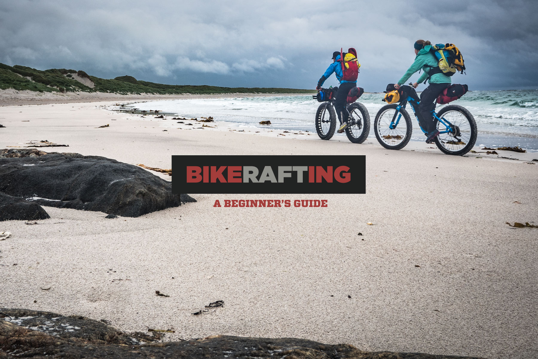
- Bikerafting knowledge is necessary: This trail is only possible with a packraft. Bikerafting: A Beginner’s Guide is a good place to start.
- River Grade: River Glass from Cannish and River Beauly from Struy to Aigas Gorge are Class 1. Moving water, unobstructed, and without technical difficulties. There may be small waves and ripples to challenge the paddler.
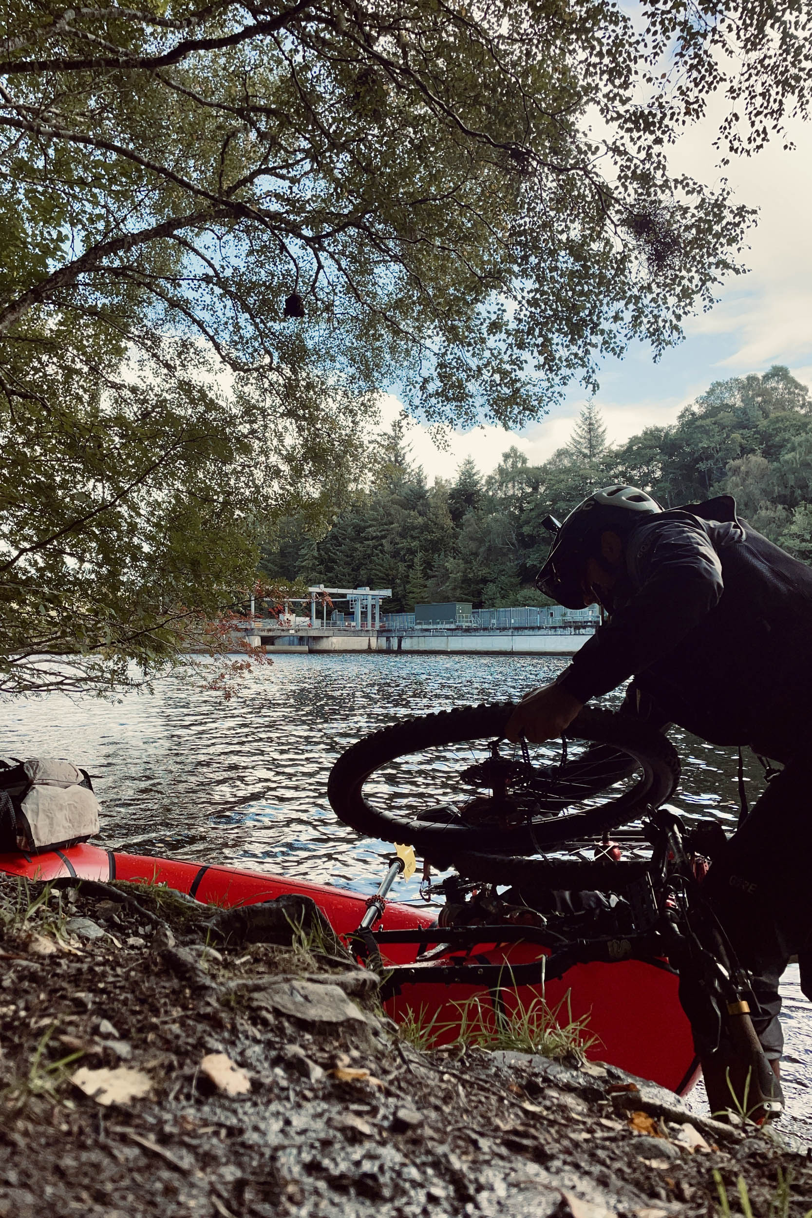
- Put-ins and take-outs: The map shows you the rough points where you can put in or take out your raft. You may need to have a look for the best spot, which may be different to what is shown on the map due to the changing nature of the lochs’ sides and the rivers’ lefts and rights. For the take-out of River Beauly, I have marked a few points on the river’s right where you can take out your raft.
- Scottish Outdoor Access Code: “Access rights extend to non-motorised water-based activities, such as canoeing, rafting, rowing and sailing. Make sure that the river, loch or reservoir is appropriate for your activity and the numbers involved, take care not to interfere unreasonably with other interests and avoid going close to water intakes, abstraction points or spillways.”
- Mullardoch Dam Overflow slipways: The closest distance you get to this dam and its power station following the route is one mile, which is a very safe distance. Getting too close to the dam, especially when the water level is high, can be very dangerous.
- Wildlife Protection: Kilmorack Community Council has a sign in Aigas Power Station car park asking paddlers to avoid the gorge from March 1st to August 15th. This is to protect the gorge’s wildlife, particularly nesting birds such as ospreys.
- Bikerafting of the Aigas Gorge: Aigas Gorge is a very popular location for paddlers with regular rafting, kayaking, and canoeing adventures going through it, but there are a couple of things to note. You must remember that after entering the gorge, the only spot for take-out is 100 metres to the Aigas Dam and Power Station. The power station has a sign near the dam warning paddlers of “Extreme Increase in Surface Currents” that “May Occur At Any Time.” I have marked this spot on the map. I have also marked a couple of take-out spots which you could take before entering the gorge, if you wish to.
- Low water level: During periods when the water level is low, seasonal islands and obstructions can emerge that are not shown on maps.
- Wind Direction: Scotland has a maritime climate that is strongly influenced by the oceanic waters of the North Atlantic and prevailing southwesterly wind. This can work in your favour when it comes to the 7.2-mile (11.6-kilometre) west-to-east rafting of Loch Mullardoch. However, rafting along and across Loch Monar from put-in spots 1 and 2 (refer to the map) is only possible in low wind speed. In high winds, you might find conditions around put-in spot 1 tranquil enough as it’s sheltered by high hills though you must be advised that 1.85 miles (3 kilometres) into your paddling, you will move around the sheltering hills and find yourself in an exposed southwesterly position for the rest of the line. In such conditions, put-in spot 3 and the .75-mile (1.25-kilometre) crossing is a safer bet.
SEPA Water Level Data
The Scottish Environment Protection Agency is in charge of monitoring and recording water levels on lochs, rivers, and coastlines. Water levels for River Glass are collected regularly from stations Fasnakyle and Kerrow Wood. For River Beauly, they are collected by stations Erchless and Red Bridge. By checking the SEPA website you will be able to monitor the water levels around the date of your trip. It is good practice to check each station individually in the days leading up to your trip. The lowest and highest levels on record for Rivers Beauly and Glass recorded at these stations are as follows:
- Beauly@Erchless; Low: 0.91m, High: 4.461m
- Beauly@Red Bridge; Low:0.189m, High: 3.571m
- Glass@Fasnakyle; Low: 0.174m, High: 2.816m
- Glass@Kerrow Wood; Low: 0.435m, High: 3.116m
Logistics
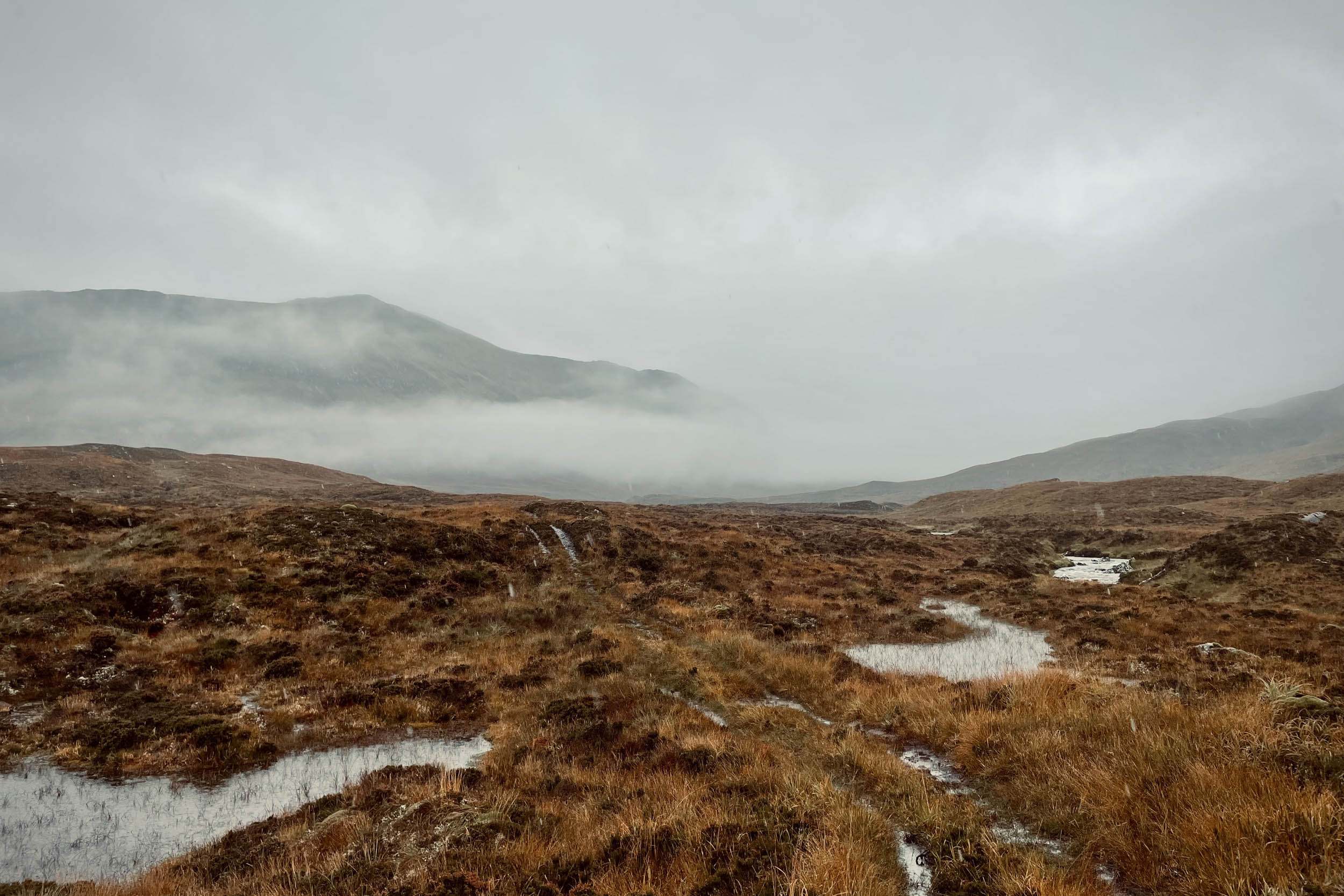
- Weather and emergency plan: Scotland’s weather can change very quickly. As the route takes you to high altitudes and keeps you up there for a while before heading down again, it is necessary to have the right kit and strategy. As sections of the trail are off-grid in remote locations, having a satellite communicator is essential in case of an emergency.
- Logistics: If you are travelling from abroad, Visit Scotland is a good website for gathering information about your visit. Inverness has train links to and from everywhere in the UK and an international airport with flights from all around the world.
- Deer Management: Stalking and fencing are the main deer management methods currently used in Scotland. Red deer stag (male) stalking currently takes place between July 1st and October 20th, with increasing activity from August. The first three weeks of October are the busiest time of the stag stalking season and a key period of the year to achieve reductions in deer numbers. Red deer hind (female) stalking takes place from October 21st to February 15th, with the end of the season often being a key period when deer managers work hard to achieve their cull targets. General advice for visiting the hills during this period is to plan ahead and pay close attention to signage on arrival and throughout your visit and use established roads and tracks. The Glenha Loop only uses established routes.
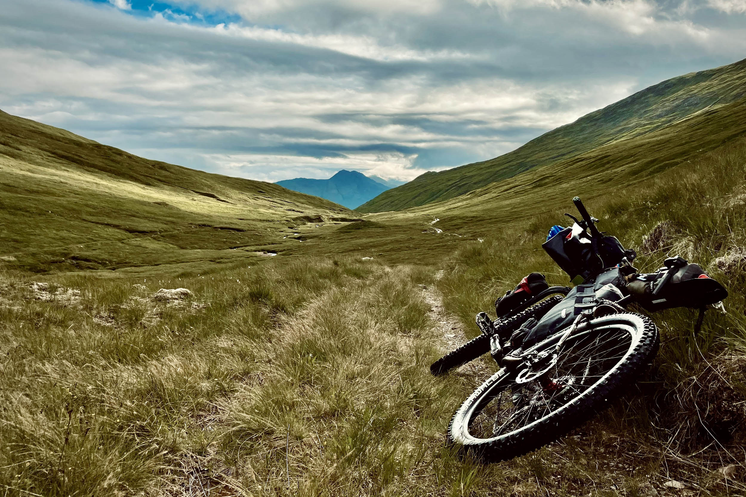
- Bike type: Glenha is a mixed-surface route. Bikes with tire widths of 2.4 to 2.8 inches are the most suitable bikes for cycling this loop.
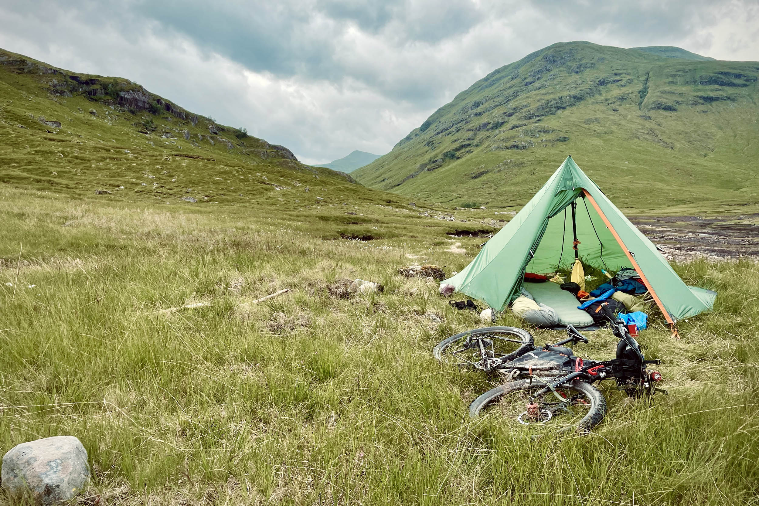
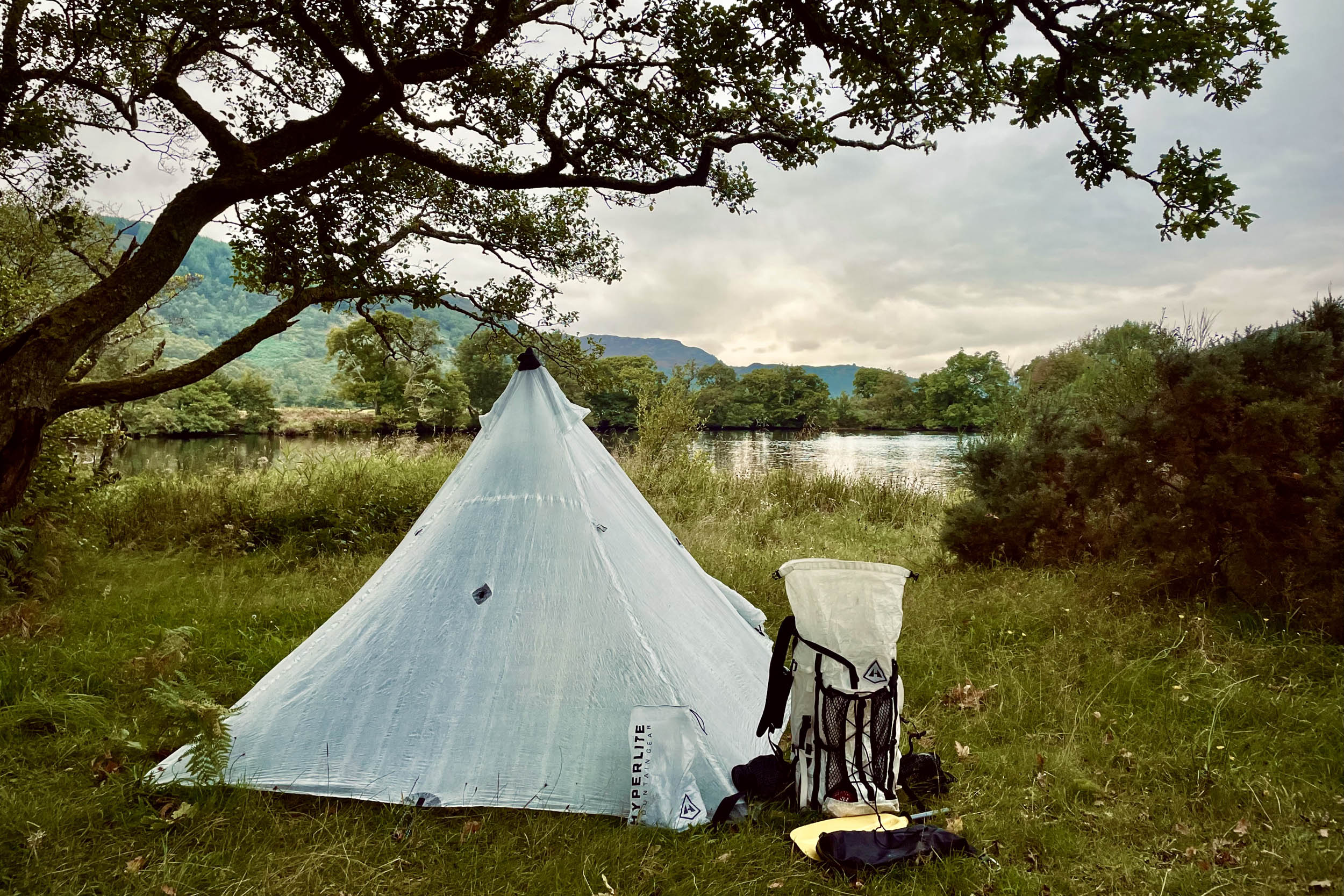
There is no shortage of good spots for camping. Four that are marked on the map are as follows:
- Half way along Loch Monar singletrack.
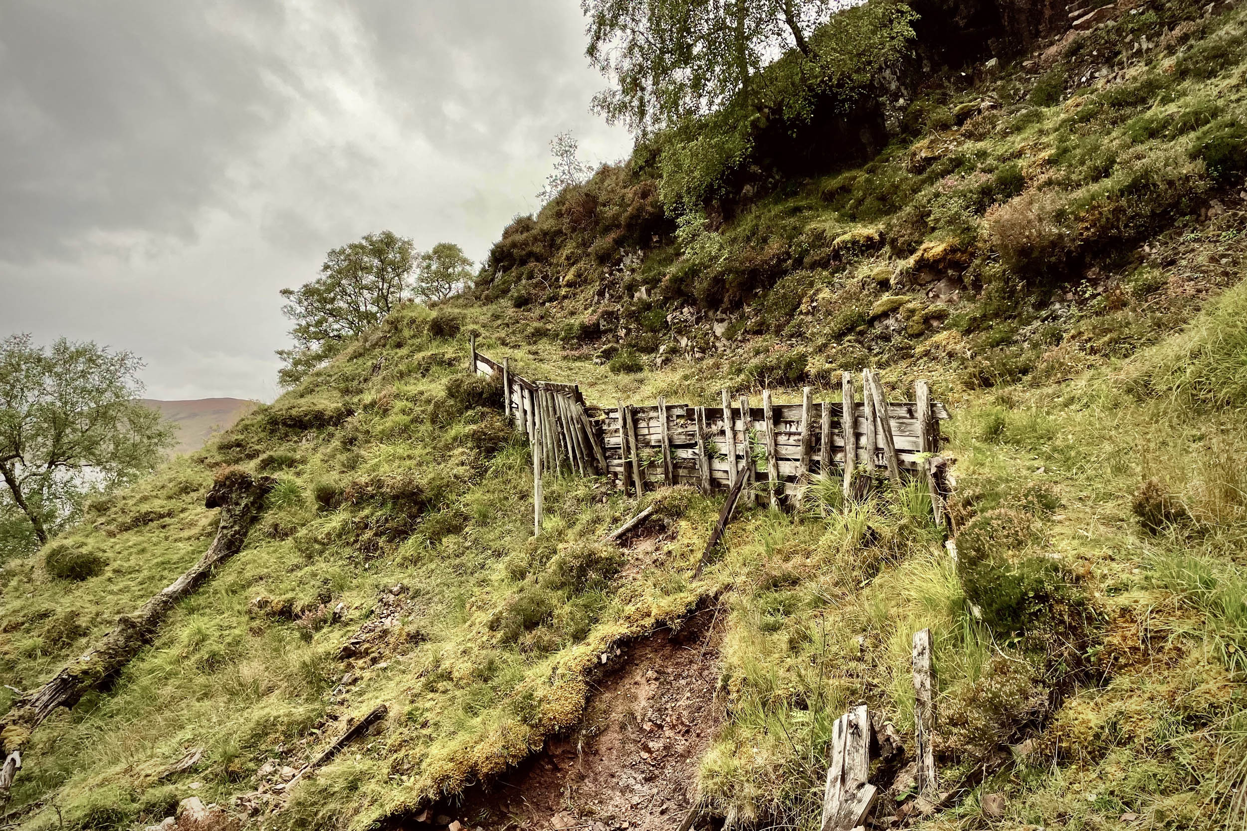
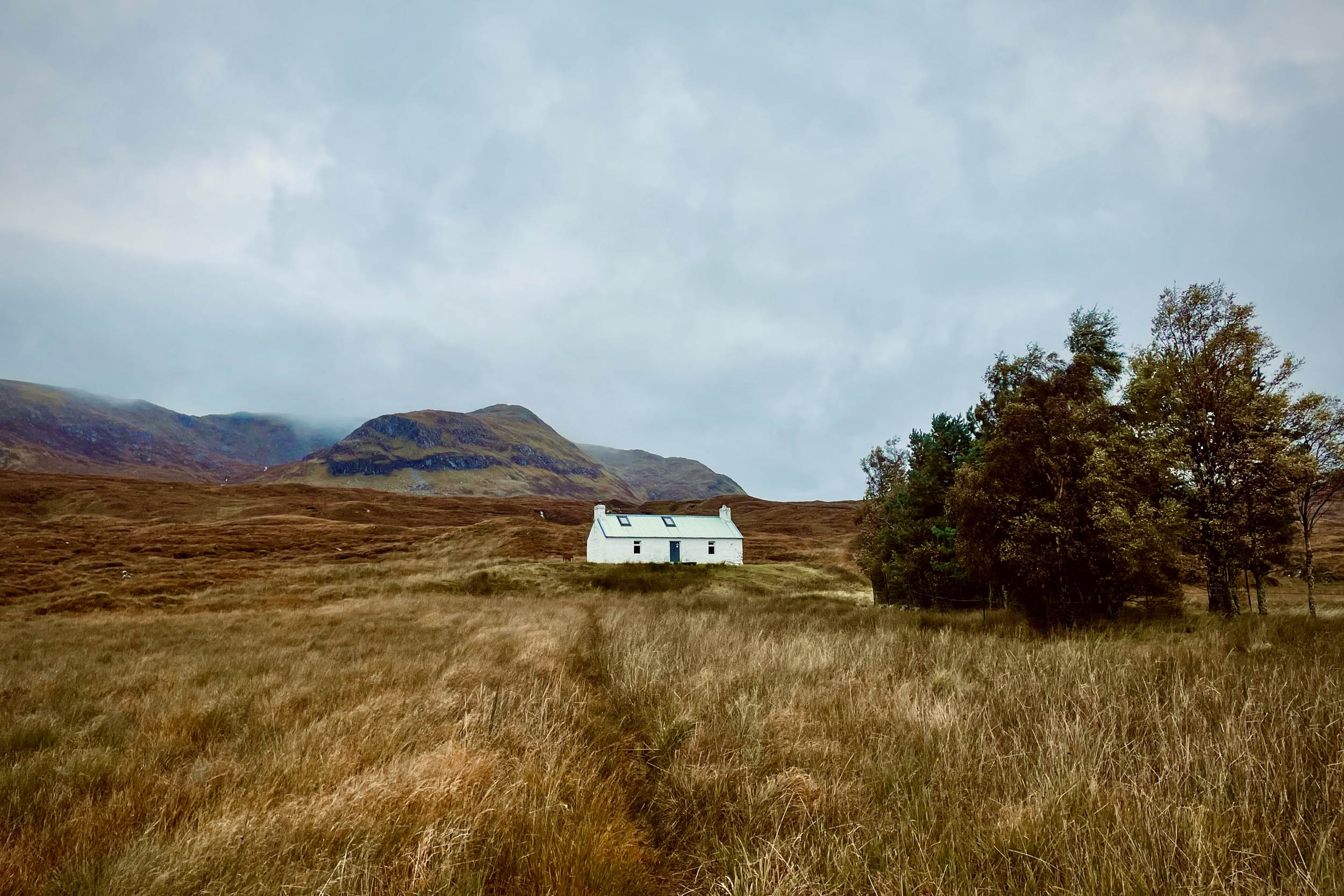
- Glen Elchaig near Iron Lodge: Iron Lodge is an abandoned lodge. The building is in a deteriorating condition and seems quite unsafe.
- Loch Mullardoch at the foot of Beinn Fhionnlaidh.
- Small peninsula in River Beauly.
- There is also a campsite in Cannish, and opening hours vary around the year.
- Out of Inverness, the only place to resupply is a Spar shop in Cannich. Cannich also has a pub restaurant.
- The Struy Inn has a bar restaurant. Contact them to enquire about their opening hours.
- Fresh water is in abundance in the Highlands! Take a water purifying filter and tablets in case you come across a dodgy stream as your only source.
These trail notes provide a guide for the whole route, split into three stages (these stages do not reflect suggested days).
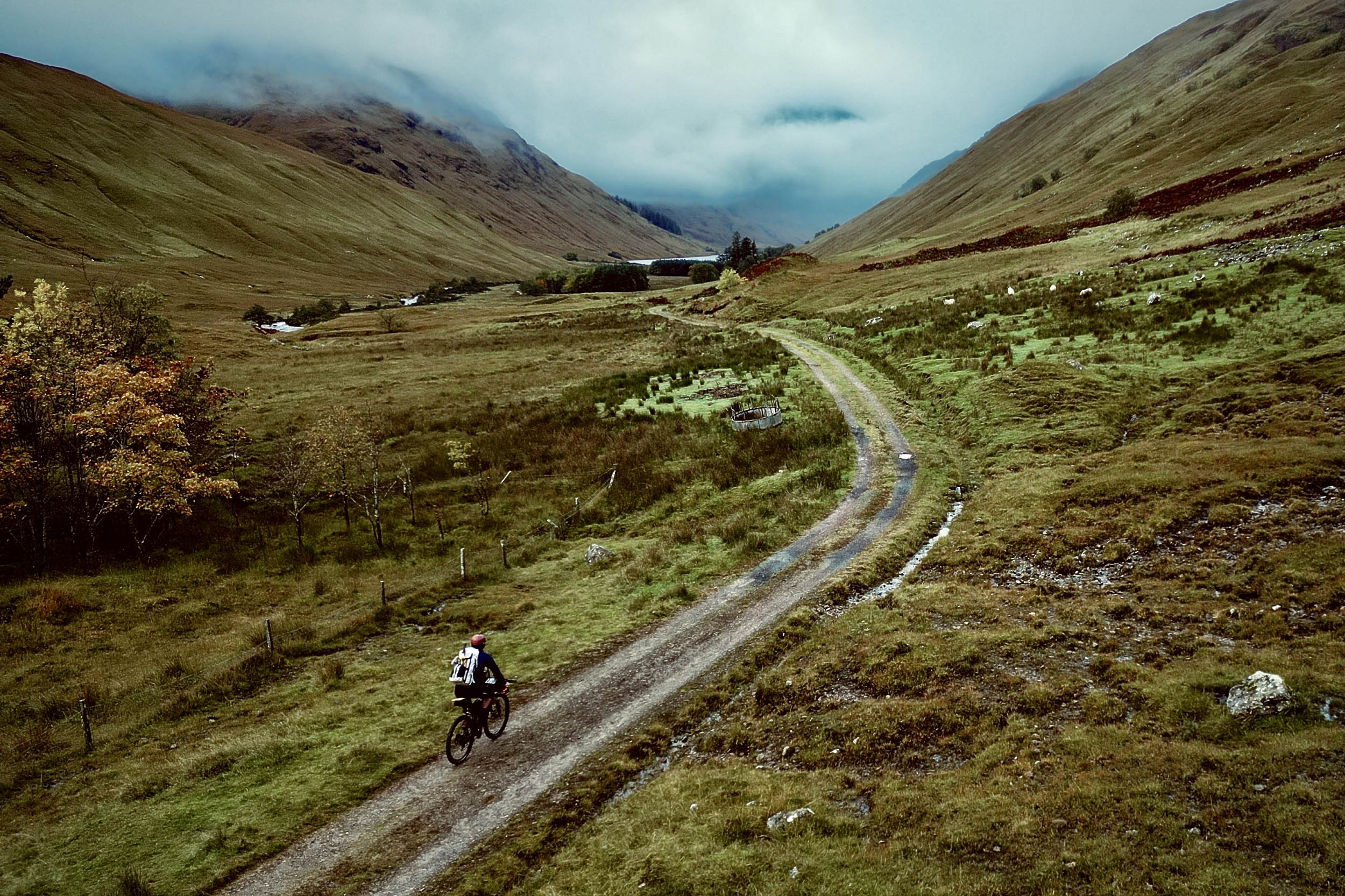
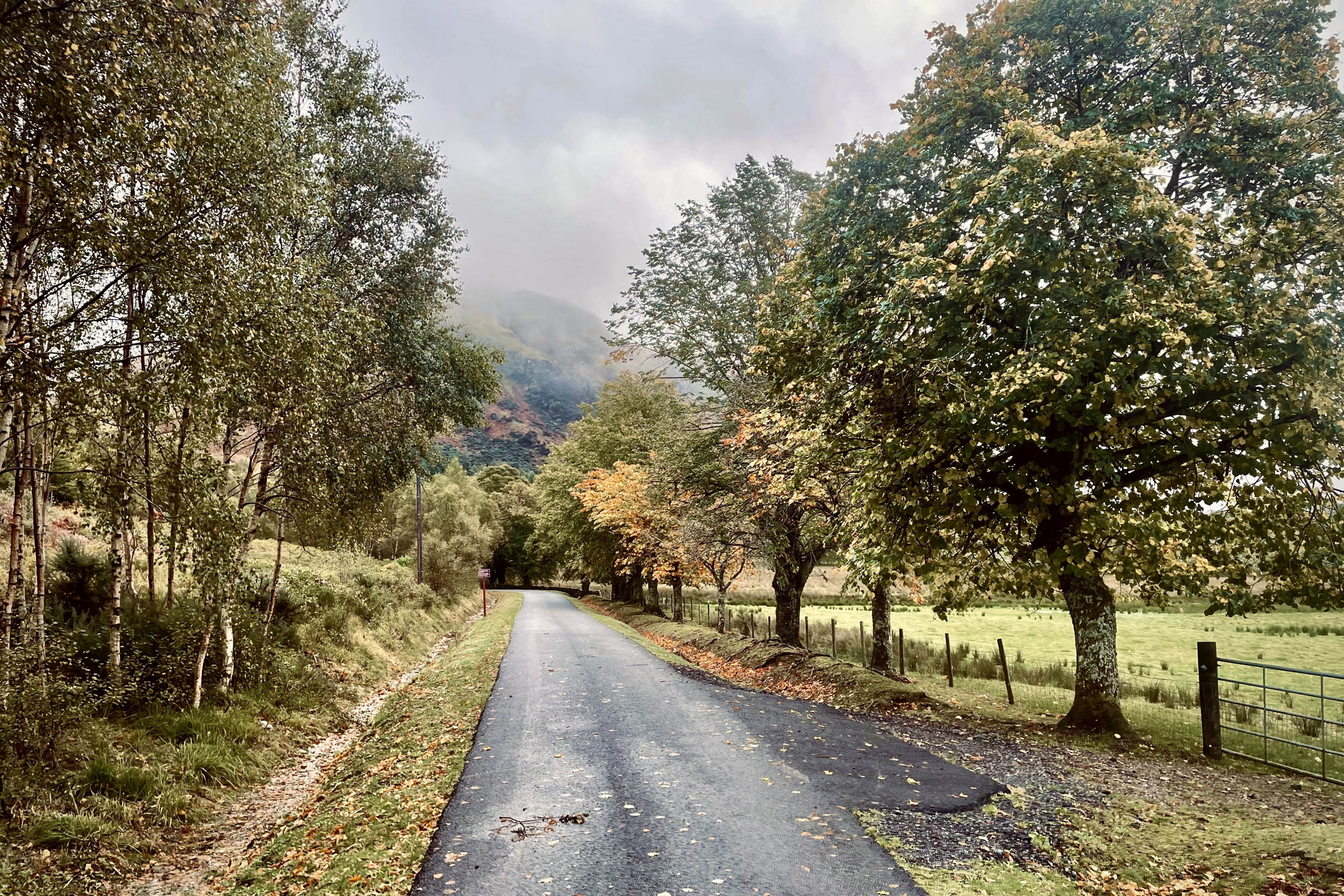
Stage 1: Inverness to Iron Lodge (90km)
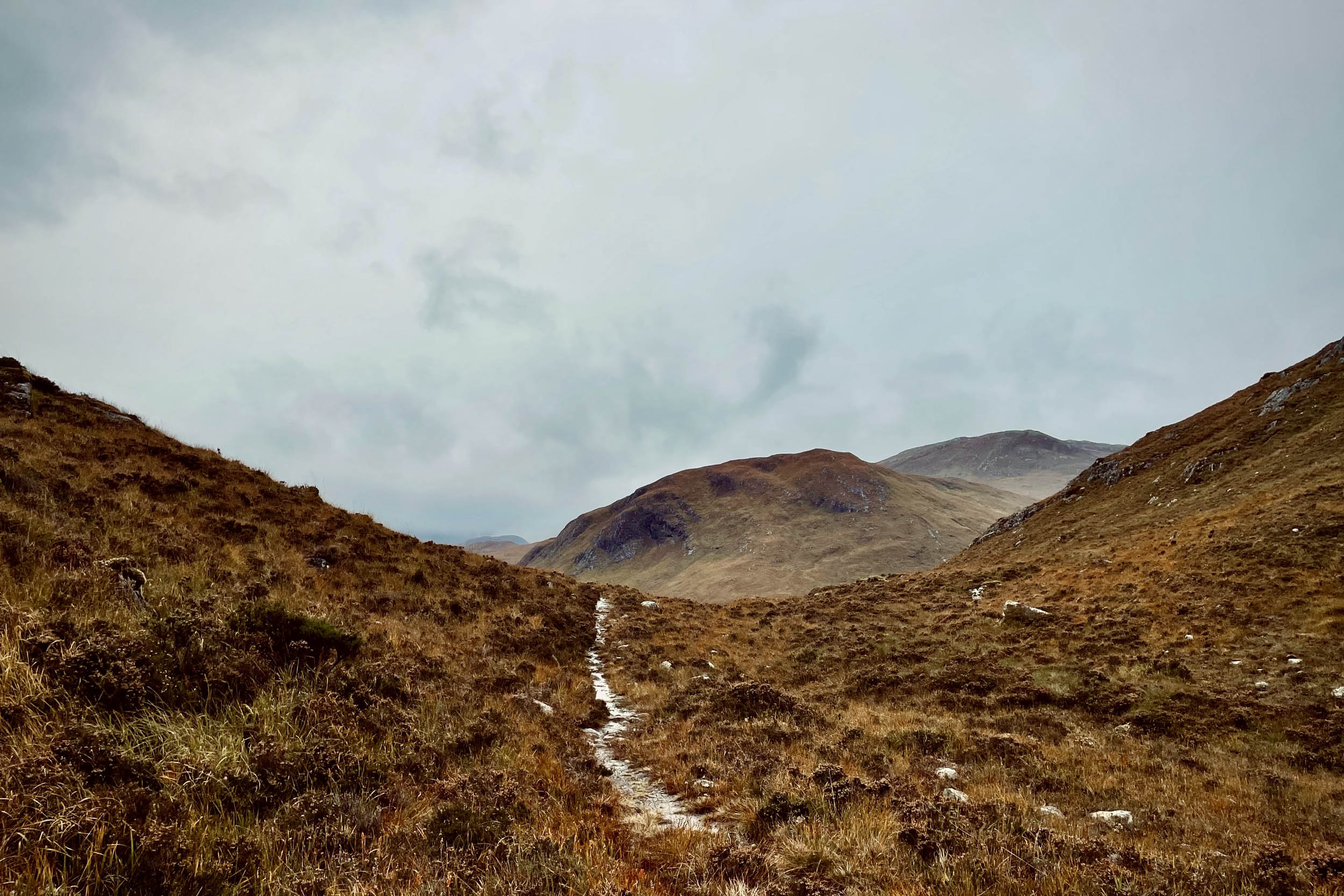
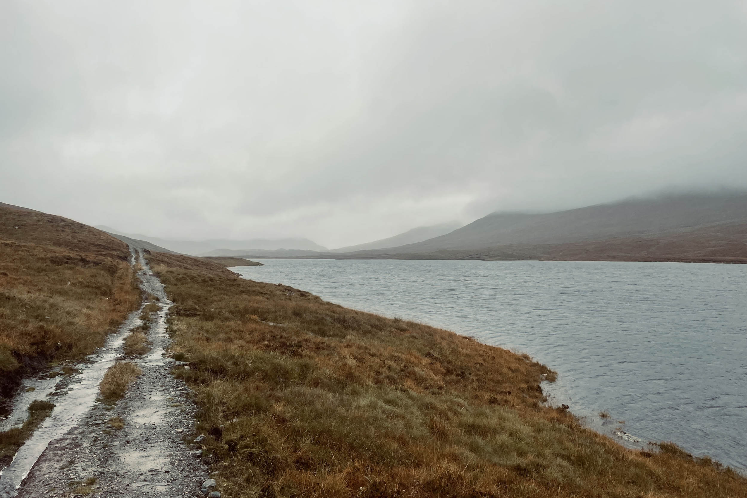
Glenha Bikerafting Loop starts in Station Square in Inverness. After cycling through the streets of Inverness, you will get to the bank of River Ness and join the Great Glen Way (GGW) for 12 kilometres; this section is a mix of paved, gravel, and mostly hardpack singletracks and is quite hilly. You will then take a right turn off the GGW and carry on over a rough gravel road to Newtonhill. From here, you will ride on quiet paved roads for 23 kilometres to Struy before turning into Glen Strathfarrar. A 22.5-kilometre paved road through this glen takes you to Monar Dam. This beautiful and quiet paved road is closed to motor vehicles (however, you might come across dam maintenance vehicles). From the dam, you will ride 10 kilometres on a 70% rideable singletrack by the side of Loch Monar to a put-in spot. Here, you have a 1.25-kilometre crossing of Loch Monar, which brings you to a gravel road.
(Alternatively, if you were up for paddling earlier, in a favourable wind condition, it’s possible to paddle along and across Loch Monar to this gravel road. Two more put-in spots are marked on the map, showing you the locations where you can prepare and put in your raft. You can find the map link to the first paddling line here. The second spot and line starts almost halfway through the 10-kilometre singletrack; you can find the link to this here).
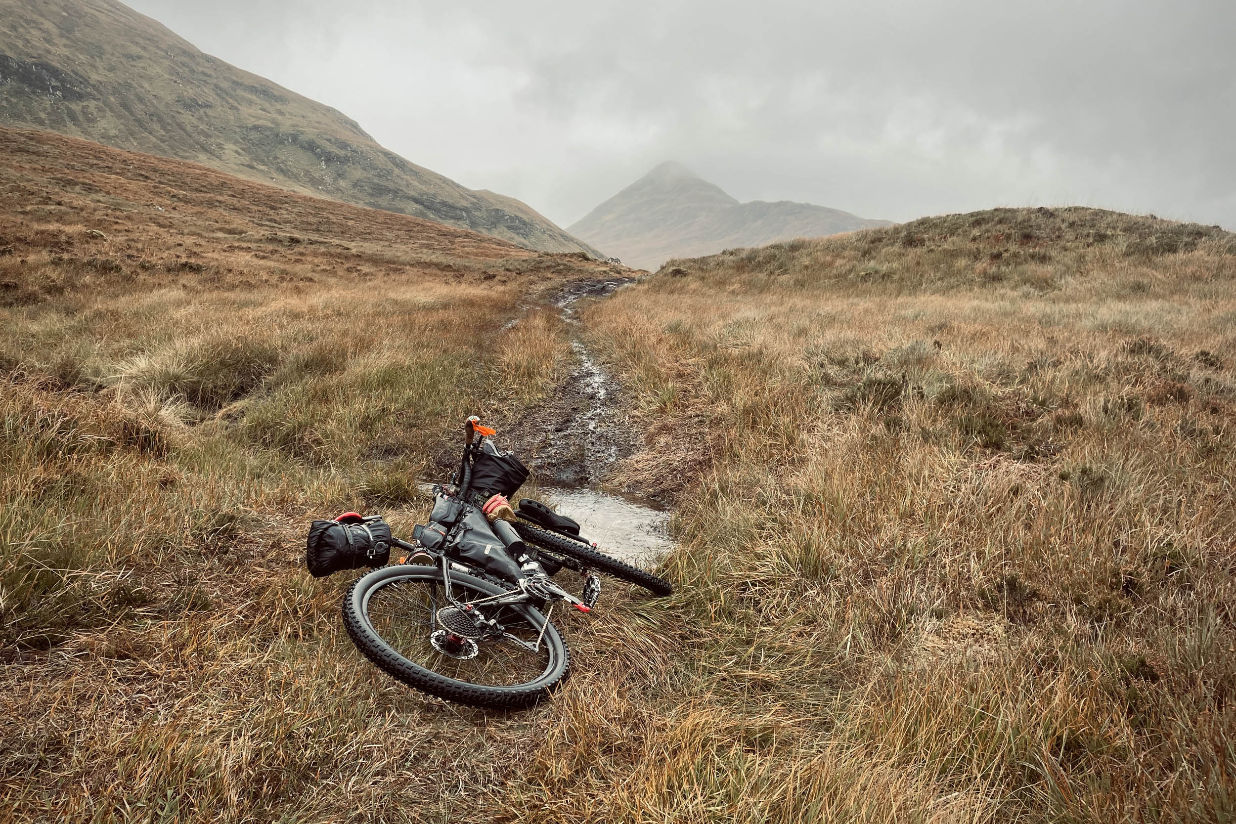
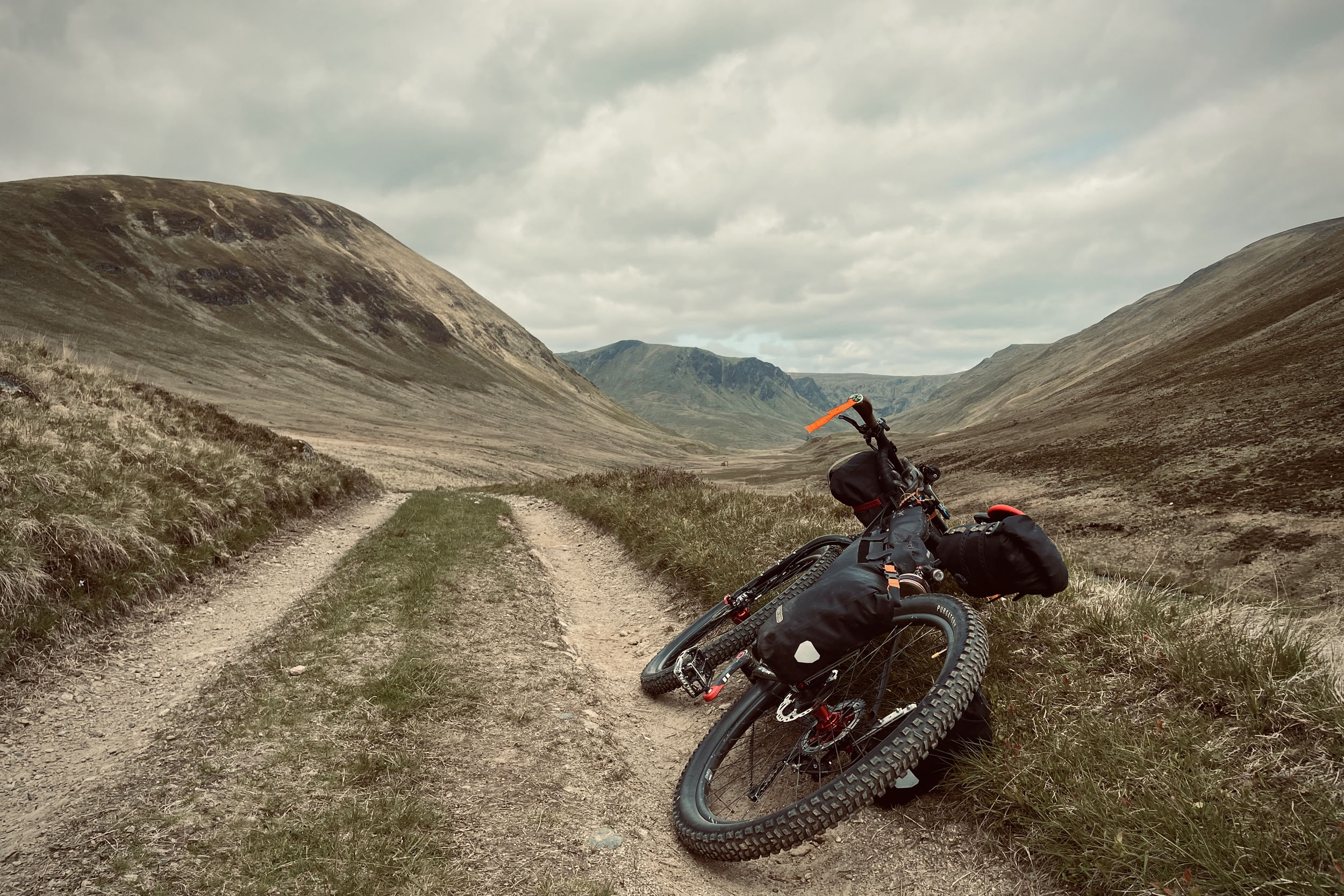
After crossing Loch Monar, there is a 15-kilometre mix of rough gravel and singletrack that takes you to Glen Elchaig and Iron Lodge, passing by a few small lochs.
(5.6 kilometres through this section, you can divert to one of the most remote bothies in the UK, Maol Bhuidhe Bothy, and rejoin the loop at Iron Lodge. This 10.7-kilometre diversion is 70% rideable over a mix of boggy singletracks and rough gravel roads, including a few burn crossings. The map to this diversion can be found here).
Stage 2: Iron Lodge to Cannich (36.5km)
(Before starting Stage 2, if you need to exit the loop for any reason, from here, you could cycle 22 kilometres to Dornie and from there, 14 kilometres to a train station in Stromeferry. This train station is a request stop, and you will need to make yourself visible to the train driver by standing on the platform and extending your arm as if you are hitchhiking—trains reduce their speed significantly before approaching request stops. This exit line to the station is 100% rideable with 8.5 kilometres of gravel. Here is the map to this exit line).
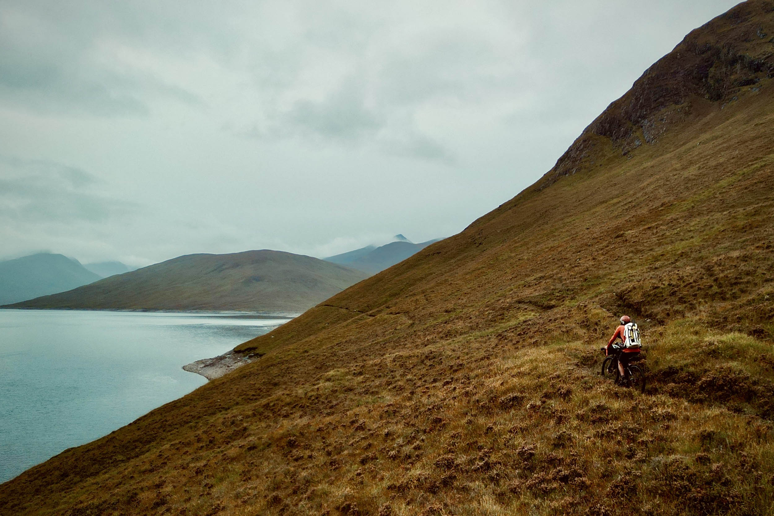
Stage 2 starts with a push up the side of Càrn na Breabaig. You then have a mix of riding and pushing for 6.5 kilometres to Glen Cannich and the Loch Mullardoch put-in (which is after the crossing of Amhain a’ Choilich burn). If you would like to climb some of the Munros, this is a good spot to camp to do these.
Now get ready for your 11.6-kilometre rafting of Loch Mullardoch. After your take-out and 1 kilometre of gravel, you will be on Glencannich Road (paved) for 15 kilometres, which brings you to Cannich.
Stage 3: Cannich to Inverness (58 km)
At Cannich, find the put-in spot marked on the map and prepare for your 23.3 kilometres rafting of River Glass and River Beauly to Aigas Gorge (find additional info about rafting Aigas Gorge in the Must Knows section). There are marks on the map helping you navigate these rivers. After entering the Aigas Gorge, the only take-out spot is within 100 metres of Aigas Dam. Take out here, pack your raft, and cycle for 3 kilometres on the A831 to Kilmorack Junction. Turn left here, cross over Black Bridge and cycle 3.9 kilometres to reach Rosebridge. Shortly after Rosebridge, you’ll be in Kiltarlity. You will then be retracing your steps/wheels over 26 kilometres back to Inverness.
(If you decide not to go through the gorge, there are take-out spots at Eskadale Church and another shortly after, which are all marked on the map. From these take-out spots, you can join a paved road and cycle 4.7 kilometres to rejoin the trail at Rosebridge).
Additional Resources


Terms of Use: As with each bikepacking route guide published on BIKEPACKING.com, should you choose to cycle this route, do so at your own risk. Prior to setting out check current local weather, conditions, and land/road closures. While riding, obey all public and private land use restrictions and rules, carry proper safety and navigational equipment, and of course, follow the #leavenotrace guidelines. The information found herein is simply a planning resource to be used as a point of inspiration in conjunction with your own due-diligence. In spite of the fact that this route, associated GPS track (GPX and maps), and all route guidelines were prepared under diligent research by the specified contributor and/or contributors, the accuracy of such and judgement of the author is not guaranteed. BIKEPACKING.com LLC, its partners, associates, and contributors are in no way liable for personal injury, damage to personal property, or any other such situation that might happen to individual riders cycling or following this route.
Further Riding and Reading
Here are some connected/nearby routes and related reports...
Please keep the conversation civil, constructive, and inclusive, or your comment will be removed.